Sites and Monuments Record · Ireland
Tomb - chest tomb
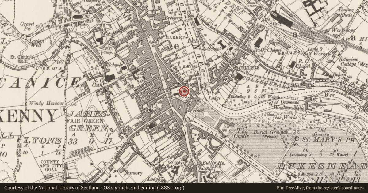
Gardens (Kilkenny City By., St. Mary’s Par.), County Kilkenny, Ireland
The record
- Townland
- Gardens (Kilkenny City By., St. Mary’s Par.)
- County
- Kilkenny
- Country
- Ireland
- First-edition OS map
- Not indicated
- Latest-edition OS map
- Not indicated
- Coordinates
- 52.65186, -7.25185
- SMR number
- KK019-026350-
Slide toward Today to fade the historical sheet and see the modern map underneath.
David Rumsey Map Collection, Stanford LibrariesUniversity Library, Vrije Universiteit AmsterdamDavid Rumsey Map Collection, Stanford LibrariesDavid Rumsey Map Collection, Stanford Libraries
4 historical maps cover this location, the earliest the 1790 map "Composite: Ireland." (David Rumsey Map Collection, Stanford Libraries).
Historical maps covering this location
- 1790 · Composite: Ireland. (David Rumsey Map Collection, Stanford Libraries)
- 1869 · Ireland. (David Rumsey Map Collection, Stanford Libraries)
- 1891 · Ireland 16 (David Rumsey Map Collection, Stanford Libraries)
- 1911 · Sheet 14, 1911 (University Library, Vrije Universiteit Amsterdam)
This record in the National Monuments Service's Historic Environment Viewer ↗
The National Monuments Service's description
At St Mary's parish church (KK019-026115-) in Kilkenny. Located beside the Renaissance mural monument of Thomas Shee and Amantissinia [Anistatia?] Dobbin (d.1636) (KK019-026349- ) on the S side of 18th-century 'Shee mausoleum', at the E end of the partially demolished medieval chancel.
An undecorated chest tomb (L 2.15m; Wth 0.85m), built of fossiliferous limestone, which sits on a moulded base. The front panel is flanked by plain pilasters. It overlies a stone vault containing disarticulated human bone, broken timber coffins and a 19th-century velvet-wrapped studded coffin. The cover slab was smashed open c. 2000 to reveal a lead-coffin, which in turn has been partially opened. Inside the coffin, fabric and wood from the interior, in addition to human skeletal, remains are visible. The damage was repaired in 2014 (Ó Drisceoil et al 2015; 2016). A rectangular lead plaque which is fixed to the wall above the altar-tomb reads:
JOHN POM(W?)ER O’SHE
FEB 1810 + 5 JULY 1859
R.I.P.
However, this probably relates to the coffin burial in the vault below rather than the interment in the chest tomb.
Compiled by: Cóilín Ó Drisceoil
Date of upload: 9 January 2023
Nearby in the register
- Wall monumentunder 1 mi
- Tomb - chest tombunder 1 mi
- Wall monumentunder 1 mi
- Headstoneunder 1 mi
Other entries of the same register within about three miles of this one, by straight line.