Sites and Monuments Record · Ireland
Kiln - corn-drying
Highhays, County Kilkenny, Ireland
The record
- Townland
- Highhays
- County
- Kilkenny
- Country
- Ireland
- First-edition OS map
- Not indicated
- Latest-edition OS map
- Not indicated
- Coordinates
- 52.65411, -7.24420
- SMR number
- KK019-026213-
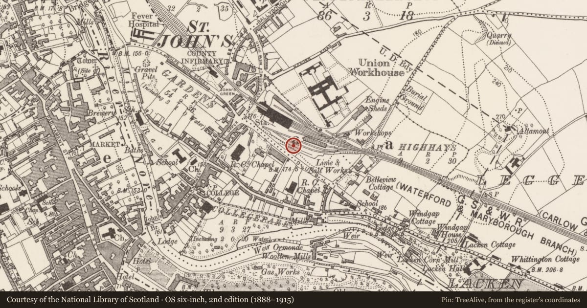
Slide toward Today to fade the historical sheet and see the modern map underneath.
David Rumsey Map Collection, Stanford LibrariesUniversity Library, Vrije Universiteit AmsterdamDavid Rumsey Map Collection, Stanford LibrariesDavid Rumsey Map Collection, Stanford Libraries
4 historical maps cover this location, the earliest the 1790 map "Composite: Ireland." (David Rumsey Map Collection, Stanford Libraries).
Historical maps covering this location
- 1790 · Composite: Ireland. (David Rumsey Map Collection, Stanford Libraries)
- 1869 · Ireland. (David Rumsey Map Collection, Stanford Libraries)
- 1891 · Ireland 16 (David Rumsey Map Collection, Stanford Libraries)
- 1911 · Sheet 14, 1911 (University Library, Vrije Universiteit Amsterdam)
This record in the National Monuments Service's Historic Environment Viewer ↗
The National Monuments Service's description
Archaeological monitoring of groundworks for part of the MacDonagh Junction Shopping Centre development was carried out by Emma Devine and Cóilín Ó Drisceoil in 2006 (Devine and Ó Drisceoil 2008, unpublished; Devine and Ó Drisceoil 2009). A corn-drying kiln and oven was excavated (06E0122) at Highhays, Dublin Road, Kilkenny. The site is situated 200m outside (NE of) the town ditch of the ward of St. John’s Kilkenny and 150m to the E of a contemporary medieval pottery production centre (KK019-026211-) which was excavated at the same time. As was the case with the pottery production centre to its W, this plot would have originally fronted onto the same street/lane that was subsumed when the Dublin Road was widened in 1818. The yard contained a cereal drying-kiln (radiocarbon dated to cal. AD 1274-1389), the burnt base of an oven and postholes for what may be an out-building/store, the remains of which were all covered by a homogenous agricultural soil horizon that belonged to the 16th/17th centuries. In the higher ground (54.50m OD) uphill to the E there was no evidence for medieval activity and it appears to have been open ground, probably agricultural land, at the time. Much of the site was preserved in situ following excavation and it may continue outside the excavated areas to the W.
Compiled by: Cóilín Ó Drisceoil
Date of upload: 30 March 2022
References
Devine, E. and Ó Drisceoil, C. 2008 Highhays, Kilkenny: a fourteenth century pottery production centre and suburb. Excavations 2006, Final Report, Kilkenny Archaeology, unpublished.
Devine, E. and Ó Drisceoil, C. 2009 MacDonagh Station, Highhays, Dublin Road, Kilkenny, Kilkenny 00E0712. In I. Bennett (ed.), Excavations 2006: summary accounts of archaeological excavations in Ireland, 271-2, no. 1054. Bray. Wordwell.
Nearby in the register
Other entries of the same register within about three miles of this one, by straight line.