Sites and Monuments Record · Ireland
Burial
Gardens (Kilkenny City By., St. Mary’s Par.), County Kilkenny, Ireland
The record
- Townland
- Gardens (Kilkenny City By., St. Mary’s Par.)
- County
- Kilkenny
- Country
- Ireland
- First-edition OS map
- Not indicated
- Latest-edition OS map
- Not indicated
- Coordinates
- 52.65307, -7.25347
- SMR number
- KK019-026200-
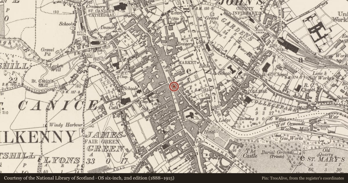
Slide toward Today to fade the historical sheet and see the modern map underneath.
David Rumsey Map Collection, Stanford LibrariesUniversity Library, Vrije Universiteit AmsterdamDavid Rumsey Map Collection, Stanford LibrariesDavid Rumsey Map Collection, Stanford Libraries
4 historical maps cover this location, the earliest the 1790 map "Composite: Ireland." (David Rumsey Map Collection, Stanford Libraries).
Historical maps covering this location
- 1790 · Composite: Ireland. (David Rumsey Map Collection, Stanford Libraries)
- 1869 · Ireland. (David Rumsey Map Collection, Stanford Libraries)
- 1891 · Ireland 16 (David Rumsey Map Collection, Stanford Libraries)
- 1911 · Sheet 14, 1911 (University Library, Vrije Universiteit Amsterdam)
This record in the National Monuments Service's Historic Environment Viewer ↗
The National Monuments Service's description
Isolated infant burial excavated in 2002-2003 (02E1715) by Cóilín Ó Drisceoil beneath former rear yard and below ground level of cellar for late 18th-early 19th century houses and shops at 62-3 High Street, (NIAH 12000076 and 12000075) and 76 Kieran Street (NIAH 12000077), Kilkenny (Ó Drisceoil 2004, 276-7; 2005, 265-6; 2005, 43-61; 2012). Excavations on the site in 2002-2003 documented a series of attempts to reclaim land (KK 019-026----) in the flood-plain of the River Nore (Ó Drisceoil 2005, 50, 59-60). Once achieved, probably in the 13th century, the site was used as a rear-garden where activities such as iron smelting (KK019-026201-) and the burial of an infant occurred. The burial was represented by fragments of the infant's skull within a deposit of gravel reclamation make-up and it is possible it was a chance introduction rather than a formal burial.
Compiled by: Cóilín Ó Drisceoil
Date of upload: 4 November 2020
References
Ó Drisceoil, C. 2005 Archaeological excavations at the rear of No. 63 High Street (OK House), Kilkenny City, Old Kilkenny Review 57, 43-61.
Ó Drisceoil, C. 2004 63 High Street (rear of), Kilkenny 02E1715, in I. Bennett (ed.) Excavations 2002: summary accounts of archaeological excavations in Ireland, no. 1013, 276-7. Bray. Wordwell.
Ó Drisceoil, C. 2012 Archaeological Assessment of proposed alterations to 76 Kieran Street/61-2 High Street, Kilkenny City 12E0110, (Kilkenny Archaeology, unpublished report).
Ó Drisceoil, C. 2005 63 High Street (rear of), Kilkenny 02E1715, in I. Bennett (ed) Excavations 2003: summary accounts of archaeological excavations in Ireland, no. 1012, 265-6. Bray, Wordwell.
Ó Drisceoil, C. 2012 63 High Street (rear of), Kilkenny. Licence no. 12E0110. Excavations.ie: database of Irish excavation reports (https://www.excavations.ie/report/2012/Kilkenny/0023413/; accessed 31 July 2020.
Nearby in the register
- Furnaceunder 1 mi
- Innunder 1 mi
- Shamblesunder 1 mi
- House - 16th/17th centuryunder 1 mi
Other entries of the same register within about three miles of this one, by straight line.