Sites and Monuments Record · Ireland
Memorial stone (present location)
Gardens (Kilkenny City By., St. Canice Par.), County Kilkenny, Ireland
The record
- Townland
- Gardens (Kilkenny City By., St. Canice Par.)
- County
- Kilkenny
- Country
- Ireland
- First-edition OS map
- Not indicated
- Latest-edition OS map
- Not indicated
- Coordinates
- 52.65613, -7.25633
- SMR number
- KK019-026186-
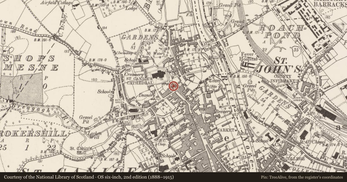
Slide toward Today to fade the historical sheet and see the modern map underneath.
David Rumsey Map Collection, Stanford LibrariesUniversity Library, Vrije Universiteit AmsterdamDavid Rumsey Map Collection, Stanford LibrariesDavid Rumsey Map Collection, Stanford Libraries
4 historical maps cover this location, the earliest the 1790 map "Composite: Ireland." (David Rumsey Map Collection, Stanford Libraries).
Historical maps covering this location
- 1790 · Composite: Ireland. (David Rumsey Map Collection, Stanford Libraries)
- 1869 · Ireland. (David Rumsey Map Collection, Stanford Libraries)
- 1891 · Ireland 16 (David Rumsey Map Collection, Stanford Libraries)
- 1911 · Sheet 14, 1911 (University Library, Vrije Universiteit Amsterdam)
This record in the National Monuments Service's Historic Environment Viewer ↗
The National Monuments Service's description
Incorporated in a relatively recently constructed low wall along the E side of Velvet Lane. In the late 19th century, Robertson (1893, 214) describes how the slab had been, ‘recently taken out of a wall in the stable-yard connected with the house at the foot of the steps leading to the Cathedral of St. Canice, which the tenant has had built into the wall of an out-office recently enlarged’. The Latin inscription in Roman Capitals in false relief reads: R.D. JACOBUS SHEE VICARIORUM COMMUNIS AULAE PROVISOR ANNO DNI 1647. The inscription refers to the ‘Common Hall’, a building which had been part of the cathedral complex (ibid.).
See attached photographs:
KK019-026186-_01 Front view of plaque
KK019-026186-_02 Location of plaque on Velvet Lane
KK019-026186-_03 Side view of plaque
Compiled by: Jean Farrelly
Date of upload: 20 December 2019
References
Robertson, J. G. 1893 Miscellanea. Journal of the Royal Society of Antiquaries of Ireland, Series 5, vol. 3, 214-16.
Lanigan, K.M. and Tyler, G. 1987 Kilkenny: its architecture & History. Kilkenny.
Nearby in the register
- Architectural fragmentunder 1 mi
- Gatewayunder 1 mi
- Memorial stoneunder 1 mi
- House - 16th/17th centuryunder 1 mi
Other entries of the same register within about three miles of this one, by straight line.