Sites and Monuments Record · Ireland
Bridge
Gardens (Kilkenny City By., St. John's Par.),Gardens (Kilkenny City By., St. Mary’s Par.), County Kilkenny, Ireland
The record
- Townland
- Gardens (Kilkenny City By., St. John's Par.),Gardens (Kilkenny City By., St. Mary’s Par.)
- County
- Kilkenny
- Country
- Ireland
- First-edition OS map
- Not indicated
- Latest-edition OS map
- Not indicated
- Coordinates
- 52.65208, -7.25033
- SMR number
- KK019-026070-
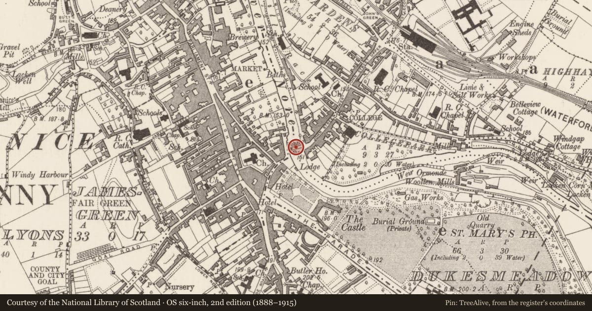
Slide toward Today to fade the historical sheet and see the modern map underneath.
David Rumsey Map Collection, Stanford LibrariesUniversity Library, Vrije Universiteit AmsterdamDavid Rumsey Map Collection, Stanford LibrariesDavid Rumsey Map Collection, Stanford Libraries
4 historical maps cover this location, the earliest the 1790 map "Composite: Ireland." (David Rumsey Map Collection, Stanford Libraries).
Historical maps covering this location
- 1790 · Composite: Ireland. (David Rumsey Map Collection, Stanford Libraries)
- 1869 · Ireland. (David Rumsey Map Collection, Stanford Libraries)
- 1891 · Ireland 16 (David Rumsey Map Collection, Stanford Libraries)
- 1911 · Sheet 14, 1911 (University Library, Vrije Universiteit Amsterdam)
This record in the National Monuments Service's Historic Environment Viewer ↗
The National Monuments Service's description
The Archaeological Survey of Ireland (ASI) is in the process of providing information on all monuments on The Historic Environment Viewer (HEV). Currently the information for this record has not been uploaded. To access available information for research purposes please make an appointment in advance with the Archive Unit (open Fridays 10.00 am – 5.00 pm), Department of Housing, Local Government and Heritage, The Custom House, Dublin 1 D01W6XO or email NMarchive@housing.gov.ie.
References
Brady, N. 2002 John’s Bridge, River Nore, Kilkenny. In I. Bennett (ed.) Excavations 2000: summary accounts of excavations in Ireland, No. 538, 178. Bray. Wordwell.
Brady, N. 2003 John’s Bridge, River Nore, Kilkenny, in I. Bennett (Ed.) Excavations 2001: summary accounts of excavations in Ireland, No. 704, 213-14. Wordwell, Bray.
Doyle, I.W. 2004 River Nore (Kilkenny City) drainage scheme: archaeological excavations at John's Bridge, Kilkenny 2001-3. Unpublished report. Margaret Gowen and Co. Ltd.
Doyle, I.W. 2003 The Lost Bridge of Kilkenny City: John’s Bridge, 1765-1910. Archaeology Ireland 17, No. 1, 8-12.
Bradley, J. 2000 Kilkenny. Irish Historic Towns Atlas no. 10. Dublin. Royal Irish Academy.
Nearby in the register
- Bridgeunder 1 mi
- Tomb - effigialunder 1 mi
- Tomb - effigialunder 1 mi
- Tomb - effigialunder 1 mi
Other entries of the same register within about three miles of this one, by straight line.