Sites and Monuments Record · Ireland
Earthwork
Courtstown, County Kilkenny, Ireland
The record
- Townland
- Courtstown
- County
- Kilkenny
- Country
- Ireland
- First-edition OS map
- Not indicated
- Latest-edition OS map
- Not indicated
- Coordinates
- 52.65246, -7.45757
- SMR number
- KK018-100001-
Slide toward Today to fade the historical sheet and see the modern map underneath.
David Rumsey Map Collection, Stanford LibrariesDavid Rumsey Map Collection, Stanford LibrariesDavid Rumsey Map Collection, Stanford LibrariesDavid Rumsey Map Collection, Stanford Libraries
4 historical maps cover this location, the earliest the 1790 map "Composite: Ireland." (David Rumsey Map Collection, Stanford Libraries).
Historical maps covering this location
- 1790 · Composite: Ireland. (David Rumsey Map Collection, Stanford Libraries)
- 1869 · Ireland. (David Rumsey Map Collection, Stanford Libraries)
- 1891 · Ireland 16 (David Rumsey Map Collection, Stanford Libraries)
- 1904 · Sheet 13. (David Rumsey Map Collection, Stanford Libraries)
This record in the National Monuments Service's Historic Environment Viewer ↗
The National Monuments Service's description
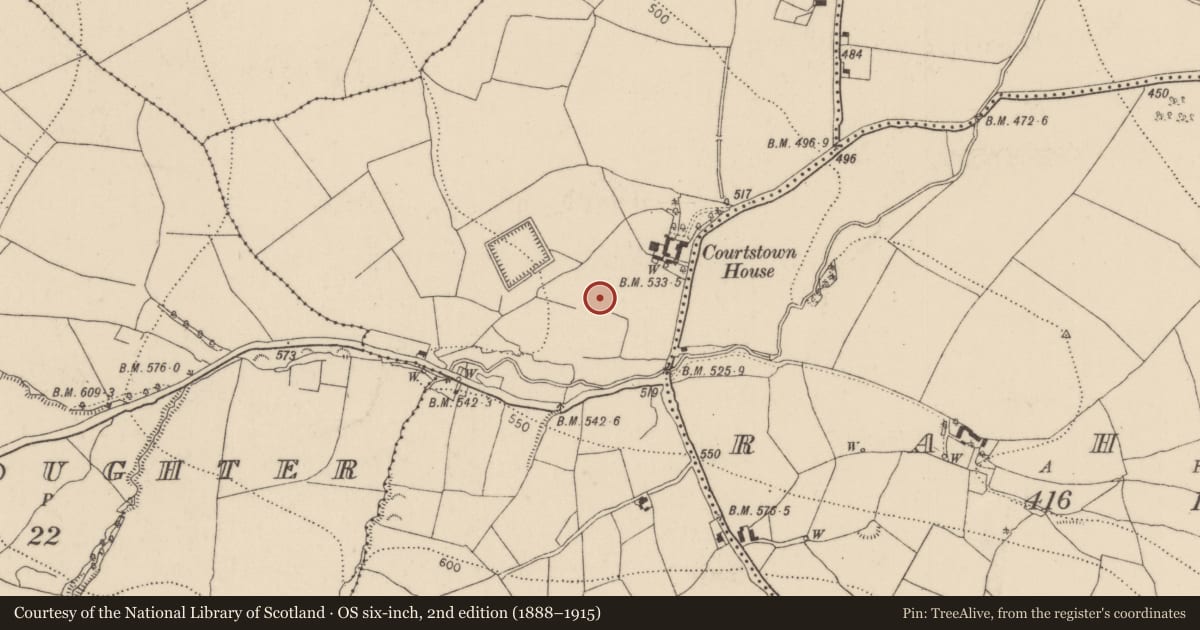
On a gentle S-facing slope in a wet marshy area. There is a good view to the SE. Identified during ASI fieldwork in 1994, a number of rectangular earthworks running NW-SE (L c. 40m NW-SE; c. 50m NE-SE). Within the most westerly there is a low horsehoe-shaped mound (KK018-100002-) enclosed by a fosse and outer bank which was interpreted as a fulacht fiadh. This feature is further enclosed with a rectangular enclosure defined by a bank (H 0.35m; Wth 3.6m), with a field boundary running along the W side and open to the SW, as is the enclosure immediately SE of it. There are two further rectangular enclosures (int. dims. 12m x 10.2m and 10.7m x 10.6m) to thhe SE, though these are on a slightly different NW-SE line, 4.6m to the SW. These are enclosed by a fosse (Wth 2.3m) and outer bank (H 0.7m; Wth 3.2m). They run into the field boundary to the SW. These earthworks are closely associated with a large square earthwork c. 20m to the W which is possibly the medieval castle (KK018-028001-) and bawn (KK018-028002-) of Courtstown. The function of these earthworks is unknown, they could be settlement features associated with the castle, however, they could also be garden features.
Compiled by: Jean Farrelly
Date of upload: 9 July 2020
Nearby in the register
- Fulacht fiaunder 1 mi
- Castle - unclassifiedunder 1 mi
- Bawnunder 1 mi
- Enclosureunder 1 mi
Other entries of the same register within about three miles of this one, by straight line.