Sites and Monuments Record · Ireland
Castle - unclassified
Oldtown (Crannagh By.), County Kilkenny, Ireland
The record
- Townland
- Oldtown (Crannagh By.)
- County
- Kilkenny
- Country
- Ireland
- First-edition OS map
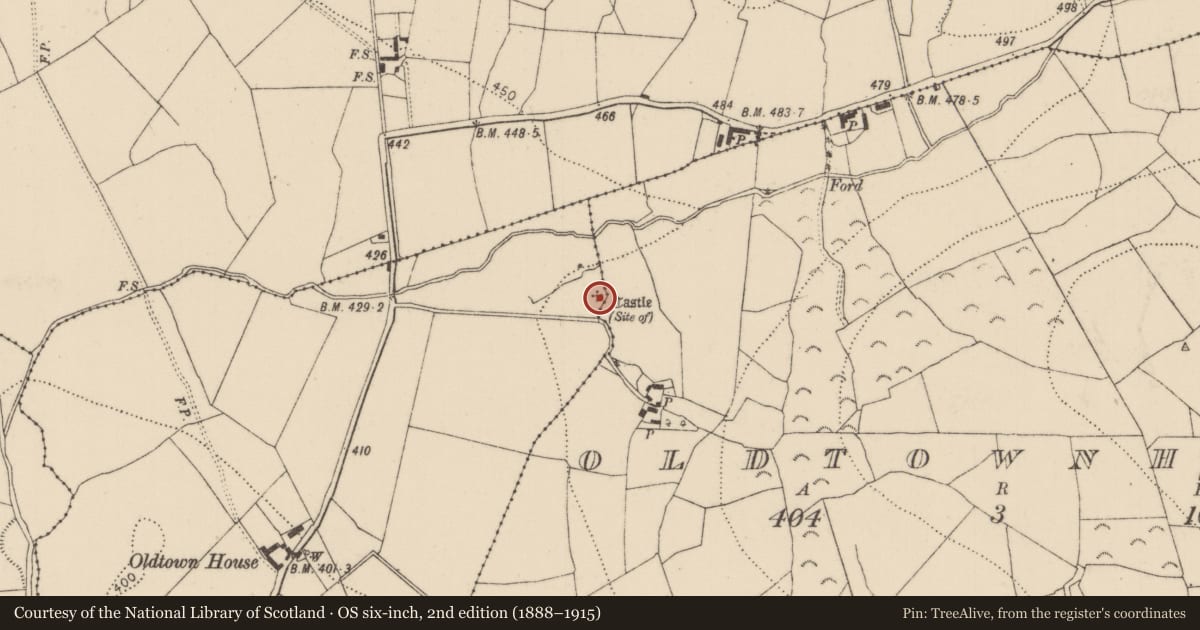
- Site of Castle
- Latest-edition OS map
- Castle (Site of)
- Coordinates
- 52.64882, -7.41850
- SMR number
- KK018-035001-
Slide toward Today to fade the historical sheet and see the modern map underneath.
David Rumsey Map Collection, Stanford LibrariesDavid Rumsey Map Collection, Stanford LibrariesDavid Rumsey Map Collection, Stanford LibrariesDavid Rumsey Map Collection, Stanford Libraries
4 historical maps cover this location, the earliest the 1790 map "Composite: Ireland." (David Rumsey Map Collection, Stanford Libraries).
Historical maps covering this location
- 1790 · Composite: Ireland. (David Rumsey Map Collection, Stanford Libraries)
- 1869 · Ireland. (David Rumsey Map Collection, Stanford Libraries)
- 1891 · Ireland 16 (David Rumsey Map Collection, Stanford Libraries)
- 1904 · Sheet 13. (David Rumsey Map Collection, Stanford Libraries)
This record in the National Monuments Service's Historic Environment Viewer ↗
The National Monuments Service's description
Indicated on the 1st (1838) ed. OS 6-inch map and 1900 revision as the site of a castle. The castle is not visible at ground level. The castle is indicated on the Down Survey (1655-6) barony map of 'Cranagh', with a large house (KK018-035002-) to the W and on the Down Survey parish map of 'Tulleroane' with two houses in the vicinity, one to the W (KK018-035002-) and one (KK018-035003-) to the S (Hibernia Regnum, courtesy of Trinity College Dublin). The terrier accompanying the parish map lists 'John Grace protest[ant]' as the proprietor of 'Ouldtowne' in 1640and states that the land was 'unforfeited', which implies that the landowner had not sided with the rebels in the 1641 Rising (ibid.).
See attached:
KK018-035001-_01 Extract from Down Survey (1655-6) barony map of 'Cranagh', Co. Kilkenny (Hibernia Regnum, courtesy of Trinity College Dublin)
KK018-035001-_02 Extract from Down Survey (1655-6) parish map of 'Tulleroane', in the barony of Crannagh, Co. Kilkenny (Hibernia Regnum, courtesy of Trinity College Dublin)
Compiled by: Jean Farrelly
Date of upload: 24 January 2022
Nearby in the register
- Enclosureunder 1 mi
- Moated siteunder 1 mi
- Water mill - horizontal-wheeledunder 1 mi
- Ringfort - unclassifiedunder 1 mi
Other entries of the same register within about three miles of this one, by straight line.