Sites and Monuments Record · Ireland
Graveyard
Kellymount, County Kilkenny, Ireland
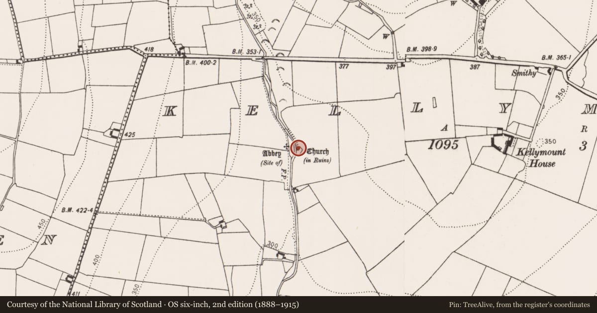
The record
- Townland
- Kellymount
- County
- Kilkenny
- Country
- Ireland
- First-edition OS map
- Not indicated
- Latest-edition OS map
- Indicated
- Coordinates
- 52.68536, -7.06063
- SMR number
- KK015-032003-
Slide toward Today to fade the historical sheet and see the modern map underneath.
David Rumsey Map Collection, Stanford LibrariesUniversity Library, Vrije Universiteit AmsterdamDavid Rumsey Map Collection, Stanford LibrariesDavid Rumsey Map Collection, Stanford Libraries
4 historical maps cover this location, the earliest the 1790 map "Composite: Ireland." (David Rumsey Map Collection, Stanford Libraries).
Historical maps covering this location
- 1790 · Composite: Ireland. (David Rumsey Map Collection, Stanford Libraries)
- 1869 · Ireland. (David Rumsey Map Collection, Stanford Libraries)
- 1891 · Ireland 16 (David Rumsey Map Collection, Stanford Libraries)
- 1904 · Sheet 14, 1904 (University Library, Vrije Universiteit Amsterdam)
This record in the National Monuments Service's Historic Environment Viewer ↗
The National Monuments Service's description
In upland river valley at the E end of a low ridge overlooking a steep river valley to the E and N, with an early medieval church (KK015-030001-) and graveyard (KK015-030002-) 85m to the E. A holy well known as St. Scoheen's Well (KK015-030006-) is incorporated into the S section of a 19th-century graveyard wall. Freneystown castle (KK015-031----) dominates the view from high ground 545m to the SE of the later medieval church and graveyard. A 19th-century C of I Church, built on and incorporating the medieval church, is located in the N quadrant of a large rectangular-shaped graveyard (int. dims. 34m N-S; 75m E-W) enclosed by a 19th-century wall (int. H 0.7m; ext. H 1.3m; wall T 0.45m). There is a medieval grave-slab (KK015-030007-) approx. 20m W of the W gable of the C of I Church, in the W quadrant of the graveyard. A possible earlier graveyard enclosure is visible as a low bank located inside the upstanding graveyard wall and is visible as a low rise of ground in SW quadrant of graveyard. All the memorials are of 18th and 19th-century date and are located in the W quadrant of the graveyard.
Compiled by: Jean Farrelly
Date of upload: 14 March 2016
Nearby in the register
- Churchunder 1 mi
- Religious house - unclassifiedunder 1 mi
- House - 17th centuryunder 1 mi
- Tunnelunder 1 mi
Other entries of the same register within about three miles of this one, by straight line.