Sites and Monuments Record · Ireland
Church
Freneystown, County Kilkenny, Ireland
The record
- Townland
- Freneystown
- County
- Kilkenny
- Country
- Ireland
- First-edition OS map
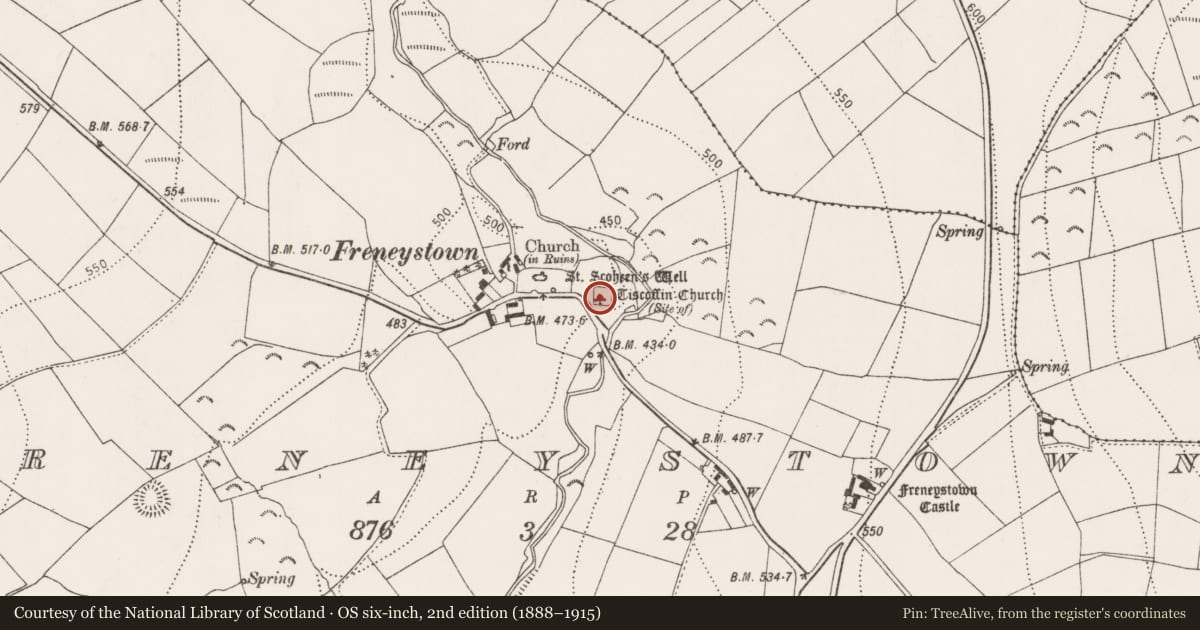
- Site of Tiscoffin Church
- Latest-edition OS map
- Tiscoffin Church (Site of)
- Coordinates
- 52.68228, -7.11675
- SMR number
- KK015-030001-
Slide toward Today to fade the historical sheet and see the modern map underneath.
David Rumsey Map Collection, Stanford LibrariesUniversity Library, Vrije Universiteit AmsterdamDavid Rumsey Map Collection, Stanford LibrariesDavid Rumsey Map Collection, Stanford Libraries
4 historical maps cover this location, the earliest the 1790 map "Composite: Ireland." (David Rumsey Map Collection, Stanford Libraries).
Historical maps covering this location
- 1790 · Composite: Ireland. (David Rumsey Map Collection, Stanford Libraries)
- 1869 · Ireland. (David Rumsey Map Collection, Stanford Libraries)
- 1891 · Ireland 16 (David Rumsey Map Collection, Stanford Libraries)
- 1904 · Sheet 14, 1904 (University Library, Vrije Universiteit Amsterdam)
This record in the National Monuments Service's Historic Environment Viewer ↗
The National Monuments Service's description
In an upland river valley at the E end of a low ridge overlooking a steep river valley immediately to E and N, with a later medieval church (KK015-030004-) and graveyard (KK015-030005-) 85m and 44m respectively to W of this church. There is a holy well, known as St. Scoheen's Well (KK015-030006-), approx. 60m W of the church and graveyard (KK015-030002-). There is no visible trace of this early medieval church at ground level. It was located in the SW quadrant of a small square-shaped graveyard. The church is marked as 'Tiscoffin Church (Site of)' on the 1900 ed. OS 6" map which is derived from the Irish Tigh Scoithin. St. Scoithin was a 6th-century monk who established a hermitage here during this period. According to local tradition the enclosure was the burial ground of seven bishops, all septuplet brothers (Carrigan 1905, vol. 3, 361)). A cross-inscribed slab (KK015-030008-) was discovered in 1950 lying along the bank of the graveyard(KK015-030002-).
Compiled by: Jean Farrelly
Date of upload: 7 March 2016
References
Carrigan, Rev. W. 1905 (Reprint 1981) The history and antiquities of the diocese of Ossory, 4 vols. Kilkenny. Roberts Books and Wellbrook Press.
Nearby in the register
- Graveyardunder 1 mi
- Inscribed slabunder 1 mi
- Graveslabunder 1 mi
- Ritual site - holy wellunder 1 mi
Other entries of the same register within about three miles of this one, by straight line.