Sites and Monuments Record · Ireland
House - 16th/17th century
Sandfordscourt, County Kilkenny, Ireland
The record
- Townland
- Sandfordscourt
- County
- Kilkenny
- Country
- Ireland
- First-edition OS map
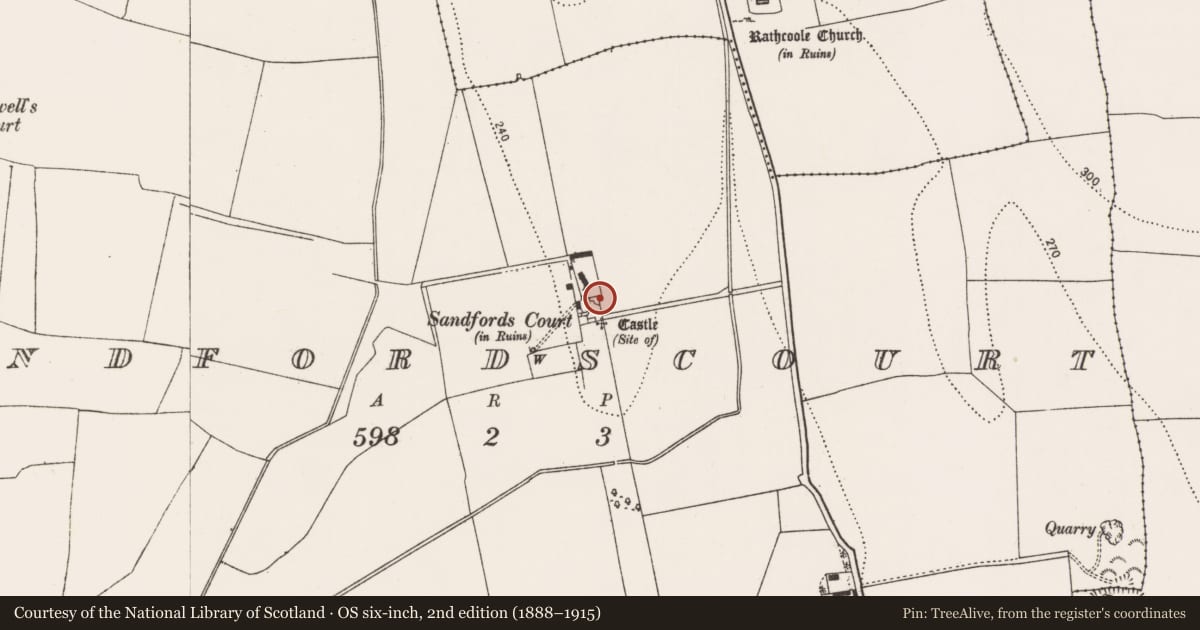
- Sandfords Court
- Latest-edition OS map
- Sandfords Court (in ruins)
- Coordinates
- 52.68715, -7.19148
- SMR number
- KK015-020002-
Slide toward Today to fade the historical sheet and see the modern map underneath.
David Rumsey Map Collection, Stanford LibrariesUniversity Library, Vrije Universiteit AmsterdamDavid Rumsey Map Collection, Stanford LibrariesDavid Rumsey Map Collection, Stanford Libraries
4 historical maps cover this location, the earliest the 1790 map "Composite: Ireland." (David Rumsey Map Collection, Stanford Libraries).
Historical maps covering this location
- 1790 · Composite: Ireland. (David Rumsey Map Collection, Stanford Libraries)
- 1869 · Ireland. (David Rumsey Map Collection, Stanford Libraries)
- 1891 · Ireland 16 (David Rumsey Map Collection, Stanford Libraries)
- 1904 · Sheet 14, 1904 (University Library, Vrije Universiteit Amsterdam)
This record in the National Monuments Service's Historic Environment Viewer ↗
The National Monuments Service's description
Set amid reclaimed rolling grassland. Fair views in all directions. Carrigan (1905, vol. 3, 274), describes the house as, 'The old building, properly called Sandford’s Court, stands in ruins some distance to the north of the castle [KK015-020001-]. It is built in the shape of an F, and was of considerable extent. The materials used in its erection were those of a demolished castle that stood immediately beside it, and that must have been of some pretensions, if one may judge from the many pieces of cut-stone, such as quoins, window and door casings, &c., taken therefrom and used as ordinary building stones, in the more modern edifice’. There is no visible trace of the house at ground level, however, it is likely that some remains, as well as architectural fragments from both the castle and house, are incorporated in the later buildings now occupying the location.
Compiled by: Jean Farrelly
Date of upload: 29 February 2016
References
Carrigan, Rev. W. 1905 (Reprint 1981) The history and antiquities of the diocese of Ossory, 4 vols. Kilkenny. Roberts Books and Wellbrook Press.
Nearby in the register
- Castle - unclassifiedunder 1 mi
- Enclosure - large enclosureunder 1 mi
- Bridgeunder 1 mi
- Settlement deserted - medievalunder 1 mi
Other entries of the same register within about three miles of this one, by straight line.