Sites and Monuments Record · Ireland
Church
Radestown North, County Kilkenny, Ireland
The record
- Townland
- Radestown North
- County
- Kilkenny
- Country
- Ireland
- First-edition OS map
- Not indicated
- Latest-edition OS map
- Not indicated
- Coordinates
- 52.68775, -7.24484
- SMR number
- KK014-066001-
Slide toward Today to fade the historical sheet and see the modern map underneath.
David Rumsey Map Collection, Stanford LibrariesUniversity Library, Vrije Universiteit AmsterdamDavid Rumsey Map Collection, Stanford LibrariesDavid Rumsey Map Collection, Stanford Libraries
4 historical maps cover this location, the earliest the 1790 map "Composite: Ireland." (David Rumsey Map Collection, Stanford Libraries).
Historical maps covering this location
- 1790 · Composite: Ireland. (David Rumsey Map Collection, Stanford Libraries)
- 1869 · Ireland. (David Rumsey Map Collection, Stanford Libraries)
- 1891 · Ireland 16 (David Rumsey Map Collection, Stanford Libraries)
- 1904 · Sheet 14, 1904 (University Library, Vrije Universiteit Amsterdam)
This record in the National Monuments Service's Historic Environment Viewer ↗
The National Monuments Service's description
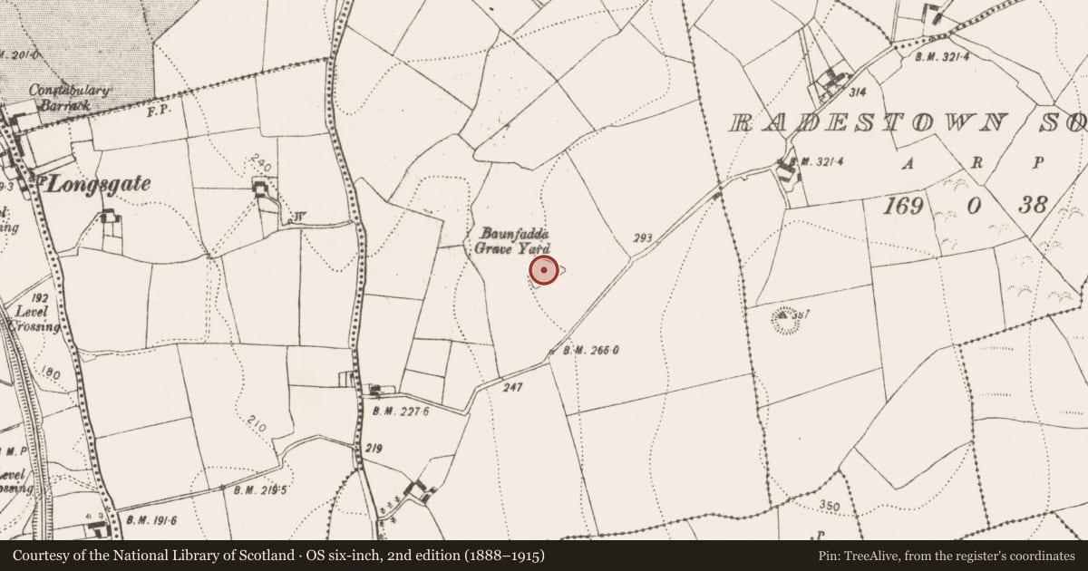
On a broad terrace on the NW side of a hill with land falling to the N and W down to a small river valley, in tillage. There are good views across the valley and along the hills but poor to the E and S where the land rises. According to Carrigan (1905, vol. 3, 267) and O'Kelly (1969, 92) the church was known as 'Teampall Bháin Fhada', which translates as the church of the long grassy field. Carrigan (1905, vol. 3, 267) notes that, 'the walls of the church have been entirely uprooted, leaving no trace behind, save only three cut and chamfered limestone pieces of a mullioned window, that lie scattered around the graveyard'. There is no visible trace of the church within the triangular-shaped graveyard (KK014-066002-), however, a pronounced rise in the centre of the graveyard may cover the remains of the church.
Compiled by: Jean Farrelly
Date of upload: 9 June 2020
References
O'Kelly, O. 1969 (Reissue 1985) The place-names of County Kilkenny. Kilkenny.
Carrigan, Rev. W. 1905 (Reprint 1981) The history and antiquities of the diocese of Ossory, 4 vols. Kilkenny. Roberts Books and Wellbrook Press.
Nearby in the register
- Graveyardunder 1 mi
- Ringfort - rathunder 1 mi
- Enclosureunder 1 mi
- Enclosureunder 1 mi
Other entries of the same register within about three miles of this one, by straight line.