Sites and Monuments Record · Ireland
Barrow - unclassified
Threecastles Demesne, County Kilkenny, Ireland
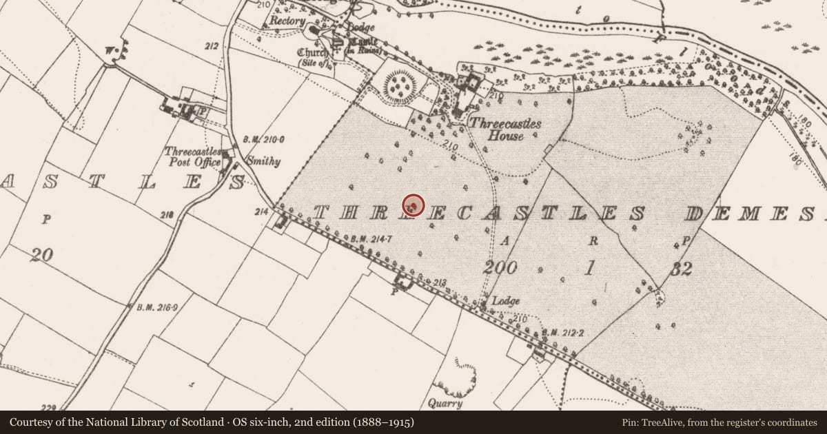
The record
- Townland
- Threecastles Demesne
- County
- Kilkenny
- Country
- Ireland
- First-edition OS map
- Not indicated
- Latest-edition OS map
- Not indicated
- Coordinates
- 52.70961, -7.32116
- SMR number
- KK014-026----
Slide toward Today to fade the historical sheet and see the modern map underneath.
David Rumsey Map Collection, Stanford LibrariesDavid Rumsey Map Collection, Stanford LibrariesDavid Rumsey Map Collection, Stanford LibrariesDavid Rumsey Map Collection, Stanford Libraries
4 historical maps cover this location, the earliest the 1790 map "Composite: Ireland." (David Rumsey Map Collection, Stanford Libraries).
Historical maps covering this location
- 1790 · Composite: Ireland. (David Rumsey Map Collection, Stanford Libraries)
- 1811 · Ireland. (David Rumsey Map Collection, Stanford Libraries)
- 1869 · Ireland. (David Rumsey Map Collection, Stanford Libraries)
- 1891 · Ireland 16 (David Rumsey Map Collection, Stanford Libraries)
This record in the National Monuments Service's Historic Environment Viewer ↗
The National Monuments Service's description
On a S-facing slope, with land rising northward to a E-W ridge overlooking the River Nore which is c. 370m N of the monument, in tillage. There are good views along the river valley. Identified as a cropmark on aerial photographs (CUCAP BGG041, 16 July 1971; BDI016 and BOC094, 10 July 1973). A multivallate enclosure (overall diam. 100m) consisting of circular central area (diam. c. 22m), possibly of a mound, enclosed by berm (Wth c. 15m); wide fosse, berm (Wth c. 11m), fosse, outer berm or bank (Wth c. 5m) and outer fosse. The outer fosse is not visible in the SW quadrant where it appears to have been truncated by a NW-SE running field boundary. When visited in 1987 the low remnants of the monument survived, consisting of a central concave platform (diam. c. 32m; int. H 0.2m; ext. H 0.4m) enclosed by a wide fosse (Wth 16m) and a low wide outer bank (Wth c. 25m; ext. H 0.25m).
See attached OS Ortho.
Compiled by: Jean Farrelly
Date of upload: 21 May 2020
Nearby in the register
- Castle - motteunder 1 mi
- Castle - unclassifiedunder 1 mi
- Settlement clusterunder 1 mi
- Graveslabunder 1 mi
Other entries of the same register within about three miles of this one, by straight line.