Sites and Monuments Record · Ireland
Church
Ballycannon, County Kilkenny, Ireland
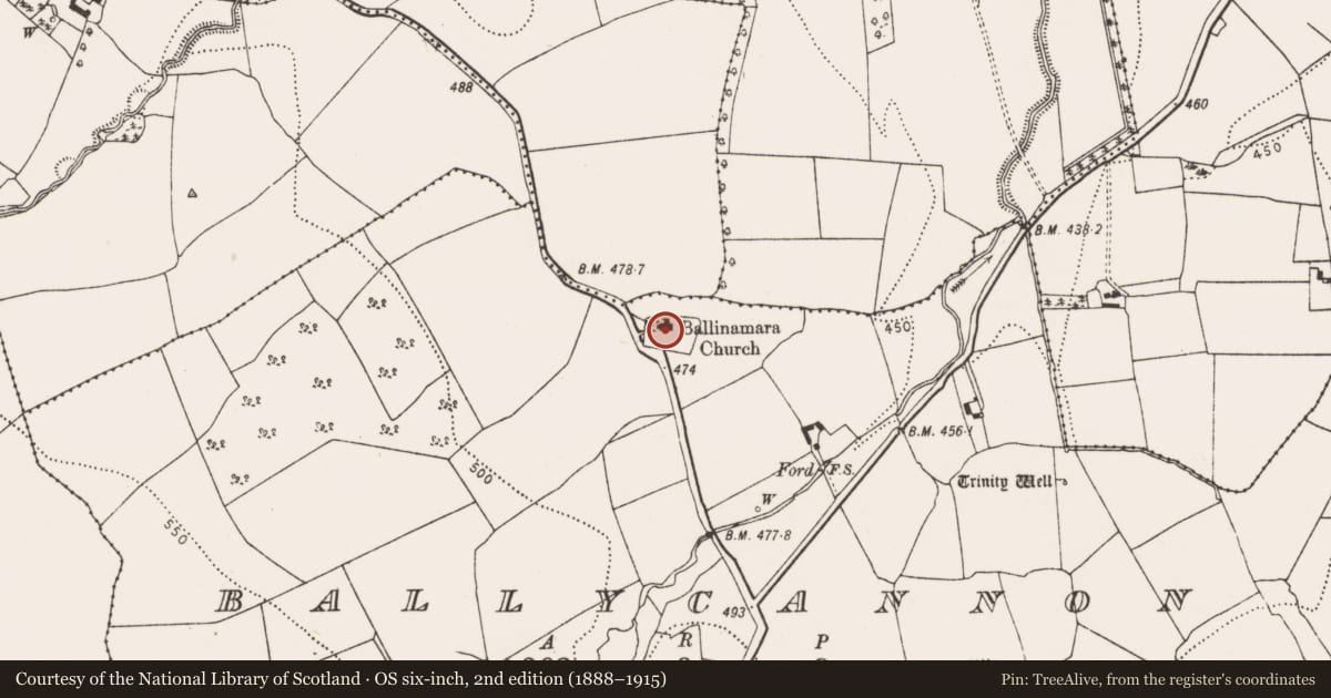
The record
- Townland
- Ballycannon
- County
- Kilkenny
- Country
- Ireland
- First-edition OS map
- Church
- Latest-edition OS map
- Ballinamara Church
- Coordinates
- 52.68786, -7.38350
- SMR number
- KK013-084001-
Slide toward Today to fade the historical sheet and see the modern map underneath.
David Rumsey Map Collection, Stanford LibrariesDavid Rumsey Map Collection, Stanford LibrariesDavid Rumsey Map Collection, Stanford LibrariesDavid Rumsey Map Collection, Stanford Libraries
4 historical maps cover this location, the earliest the 1790 map "Composite: Ireland." (David Rumsey Map Collection, Stanford Libraries).
Historical maps covering this location
- 1790 · Composite: Ireland. (David Rumsey Map Collection, Stanford Libraries)
- 1868 · 4. Ireland. (David Rumsey Map Collection, Stanford Libraries)
- 1869 · Ireland. (David Rumsey Map Collection, Stanford Libraries)
- 1891 · Ireland 16 (David Rumsey Map Collection, Stanford Libraries)
This record in the National Monuments Service's Historic Environment Viewer ↗
The National Monuments Service's description
On the floor of a valley, in reclaimed grassland. There are good views in all directions within the valley. According to the OS Letters (1839), there is, 'a new Protestant Church built on the site of the old church, which they say was called the Church of the Trinity. There is a large burying ground attached to it. There was a Patron held here on Trinity Sunday until twenty years ago' (O'Flanagan 1930, vol. 1, 207 (69)). Carrigan (1905, vol. 2, 266) agrees that the, 'ancient church of Ballinamarra, dedicated to the Most Holy Trinity, has been razed to the ground, and a modern Protestant church built on the site'. The C of I church is located in the NW quadrant of a roughly rectangular graveyard (KK013-084002-). According to O'Kelly (1969 (1985 reprint), 4) the C of I church was 'closed to Divine Service since 1945'. A holy well known as 'Trinity Well' is located c. 500m to the SE.
Compiled by: Jean Farrelly
Date of upload: 30 March 2020
References
O'Flanagan, Rev. M. (Compiler) 1930 Letters containing information relative to the antiquities of the county of Kilkenny collected during the progress of the Ordnance Survey in 1839. Bray.
O'Kelly, O. 1969 (Reissue 1985) The place-names of County Kilkenny. Kilkenny.
Carrigan, Rev. W. 1905 (Reprint 1981) The history and antiquities of the diocese of Ossory, 4 vols. Kilkenny. Roberts Books and Wellbrook Press.
Nearby in the register
- Graveyardunder 1 mi
- Ritual site - holy wellunder 1 mi
- Ringfort - rathunder 1 mi
- Enclosureunder 1 mi
Other entries of the same register within about three miles of this one, by straight line.