Sites and Monuments Record · Ireland
Castle - unclassified
Clashacrow, County Kilkenny, Ireland
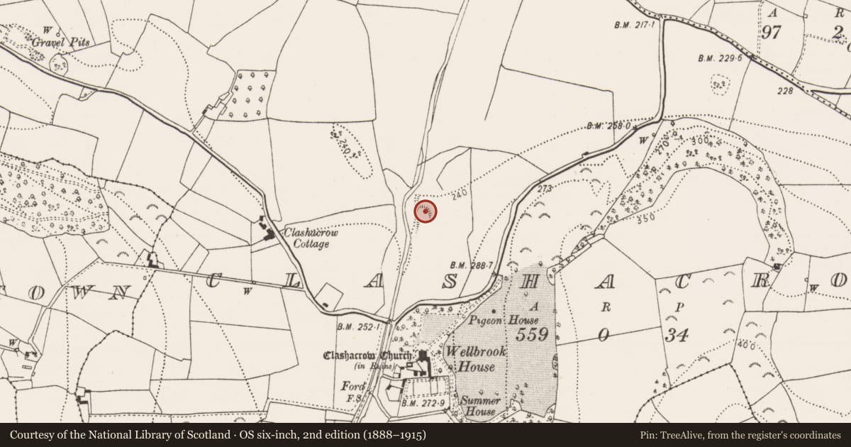
The record
- Townland
- Clashacrow
- County
- Kilkenny
- Country
- Ireland
- First-edition OS map
- Not indicated
- Latest-edition OS map
- Hachured
- Coordinates
- 52.72126, -7.37454
- SMR number
- KK013-050----
Slide toward Today to fade the historical sheet and see the modern map underneath.
David Rumsey Map Collection, Stanford LibrariesDavid Rumsey Map Collection, Stanford LibrariesDavid Rumsey Map Collection, Stanford LibrariesDavid Rumsey Map Collection, Stanford Libraries
4 historical maps cover this location, the earliest the 1790 map "Composite: Ireland." (David Rumsey Map Collection, Stanford Libraries).
Historical maps covering this location
- 1790 · Composite: Ireland. (David Rumsey Map Collection, Stanford Libraries)
- 1811 · Ireland. (David Rumsey Map Collection, Stanford Libraries)
- 1869 · Ireland. (David Rumsey Map Collection, Stanford Libraries)
- 1891 · Ireland 16 (David Rumsey Map Collection, Stanford Libraries)
This record in the National Monuments Service's Historic Environment Viewer ↗
The National Monuments Service's description
On a slight E-W ridge on the E bank of the Arigna river, where the river enters Nuenna river valley, in pasture. Land rises steeply to E, otherwise there are good views across both valleys of opposing highlands. According to Carrigan (1905, vol. 2, 264), 'about 300 yards north of the church [KK013-05101-], and on the same side of the Arganny river, the site of a demolished castle is still pointed out in the "caste field". It is indicated on the 1900 edition of the OS 6-inch map as a mound (dims. c. 30m N-S; c. 26m E-W) which tapers off to the S, the scarp on the W side of the mound continues southward for a further c. 30m and there is also scarp (L c. 22m) indicated N of the mound, falling towards the river. The land has been reclaimed and the castle and mound are not visible at ground level.
Compiled by: Jean Farrelly
Date of upload: 21 December 2016
References
Carrigan, Rev. W. 1905 (Reprint 1981) The history and antiquities of the diocese of Ossory, 4 vols. Kilkenny. Roberts Books and Wellbrook Press.
Nearby in the register
- Dovecoteunder 1 mi
- Churchunder 1 mi
- Graveyardunder 1 mi
- Ring-ditchunder 1 mi
Other entries of the same register within about three miles of this one, by straight line.