Sites and Monuments Record · Ireland
Enclosure
Connahy, County Kilkenny, Ireland
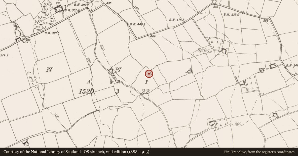
The record
- Townland
- Connahy
- County
- Kilkenny
- Country
- Ireland
- First-edition OS map
- Not indicated
- Latest-edition OS map
- Not indicated
- Coordinates
- 52.76532, -7.30127
- SMR number
- KK010-094002-
Slide toward Today to fade the historical sheet and see the modern map underneath.
David Rumsey Map Collection, Stanford LibrariesDavid Rumsey Map Collection, Stanford LibrariesDavid Rumsey Map Collection, Stanford LibrariesDavid Rumsey Map Collection, Stanford Libraries
4 historical maps cover this location, the earliest the 1790 map "Composite: Ireland." (David Rumsey Map Collection, Stanford Libraries).
Historical maps covering this location
- 1790 · Composite: Ireland. (David Rumsey Map Collection, Stanford Libraries)
- 1811 · Ireland. (David Rumsey Map Collection, Stanford Libraries)
- 1869 · Ireland. (David Rumsey Map Collection, Stanford Libraries)
- 1891 · Ireland 16 (David Rumsey Map Collection, Stanford Libraries)
This record in the National Monuments Service's Historic Environment Viewer ↗
The National Monuments Service's description
Carrigan (1905, vol. 2, 194) records that in Connahy townland, 'A half a mile [c. 800m] north-west of the chapel there is a field, three-quarters of an acre in extent, called the Shannavŏhaun, or old hut. A square enclosure here, 53 yards [c. 48.5m] across, with rampart and fosse, is said to have been the site of an ancient monastery. Whenever tilled the enclosure presented all the appearance of a graveyard [KK010-094002-]'. According to local information a field c. 1km NW of St. Coleman's church is still known as 'Shannovohaun' and within this field there is a roughly square enclosure (visible on Digitalglobe satellite imagery, viewed 5 July 2019) which seems to correspond with the enclosure described by Carrigan.
Compiled by: Jean Farrelly
Date of revised upload: 5 July 2019
References
Carrigan, Rev. W. 1905 (Reprint 1981) The history and antiquities of the diocese of Ossory, 4 vols. Kilkenny. Roberts Books and Wellbrook Press.
Nearby in the register
- Burial groundunder 1 mi
- Enclosureunder 1 mi
- Ringfort - rathunder 1 mi
- Castle - unclassifiedunder 1 mi
Other entries of the same register within about three miles of this one, by straight line.