Sites and Monuments Record · Ireland
House - 16th/17th century
Baunmore (Galmoy By.), County Kilkenny, Ireland
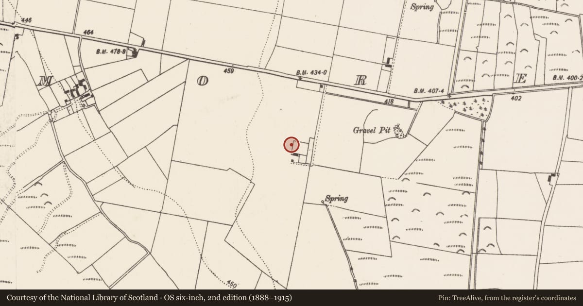
The record
- Townland
- Baunmore (Galmoy By.)
- County
- Kilkenny
- Country
- Ireland
- First-edition OS map
- Not indicated
- Latest-edition OS map
- Not indicated
- Coordinates
- 52.75104, -7.62132
- SMR number
- KK008-108002-
Slide toward Today to fade the historical sheet and see the modern map underneath.
David Rumsey Map Collection, Stanford LibrariesDavid Rumsey Map Collection, Stanford LibrariesDavid Rumsey Map Collection, Stanford LibrariesDavid Rumsey Map Collection, Stanford Libraries
4 historical maps cover this location, the earliest the 1790 map "Composite: Ireland." (David Rumsey Map Collection, Stanford Libraries).
Historical maps covering this location
- 1790 · Composite: Ireland. (David Rumsey Map Collection, Stanford Libraries)
- 1868 · 4. Ireland. (David Rumsey Map Collection, Stanford Libraries)
- 1869 · Ireland. (David Rumsey Map Collection, Stanford Libraries)
- 1891 · Ireland 16 (David Rumsey Map Collection, Stanford Libraries)
This record in the National Monuments Service's Historic Environment Viewer ↗
The National Monuments Service's description
In low-lying, flat, slightly undulating terrain in grassland. There are good views in all directions. Depicted on the Down Survey (1655-6) map as an elaborate house and described as 'a faire stone house'. According to Carrigan (1905, vol. 2, 303), 'Bawnmore House, the former residence of the Bryans, and now in ruins, dates from about 1700. A little to the north of it, near the end of the garden, there are the remains of a much more ancient residence [KK008-108002-]'. The 'ancient residence' referred to by Carrigan is probably the house depicted on the Down Survey (1655-6) map. Though not visible at ground level, Carrigan's description suggests a location N of Baunmore House and immediately W of the garden which is shown on the 1st (1839) ed. OS 6-inch map.
Compiled by: Jean Farrelly
Date of upload: 17 January 2018
References
Carrigan, Rev. W. 1905 (Reprint 1981) The history and antiquities of the diocese of Ossory, 4 vols. Kilkenny. Roberts Books and Wellbrook Press.
Nearby in the register
- House - 17th centuryunder 1 mi
- Megalithic tomb - unclassifiedunder 1 mi
- Structure - peatlandunder 1 mi
- Road - class 3 togherunder 1 mi
Other entries of the same register within about three miles of this one, by straight line.