Sites and Monuments Record · Ireland
Cross-inscribed stone
Garranes (Glanarought By., Banawn ED), County Kerry, Ireland
The record
- Townland
- Garranes (Glanarought By., Banawn ED)
- County
- Kerry
- Country
- Ireland
- First-edition OS map
- Not indicated
- Latest-edition OS map
- Not indicated
- Coordinates
- 51.81958, -9.49868
- SMR number
- KE102-038007-
Slide toward Today to fade the historical sheet and see the modern map underneath.
David Rumsey Map Collection, Stanford LibrariesDavid Rumsey Map Collection, Stanford LibrariesDavid Rumsey Map Collection, Stanford LibrariesDavid Rumsey Map Collection, Stanford Libraries
4 historical maps cover this location, the earliest the 1790 map "Composite: Ireland." (David Rumsey Map Collection, Stanford Libraries).
Historical maps covering this location
- 1790 · Composite: Ireland. (David Rumsey Map Collection, Stanford Libraries)
- 1865 · Ireland, (South) Sheet. (David Rumsey Map Collection, Stanford Libraries)
- 1869 · Ireland. (David Rumsey Map Collection, Stanford Libraries)
- 1891 · Ireland 16 (David Rumsey Map Collection, Stanford Libraries)
This record in the National Monuments Service's Historic Environment Viewer ↗
The National Monuments Service's description
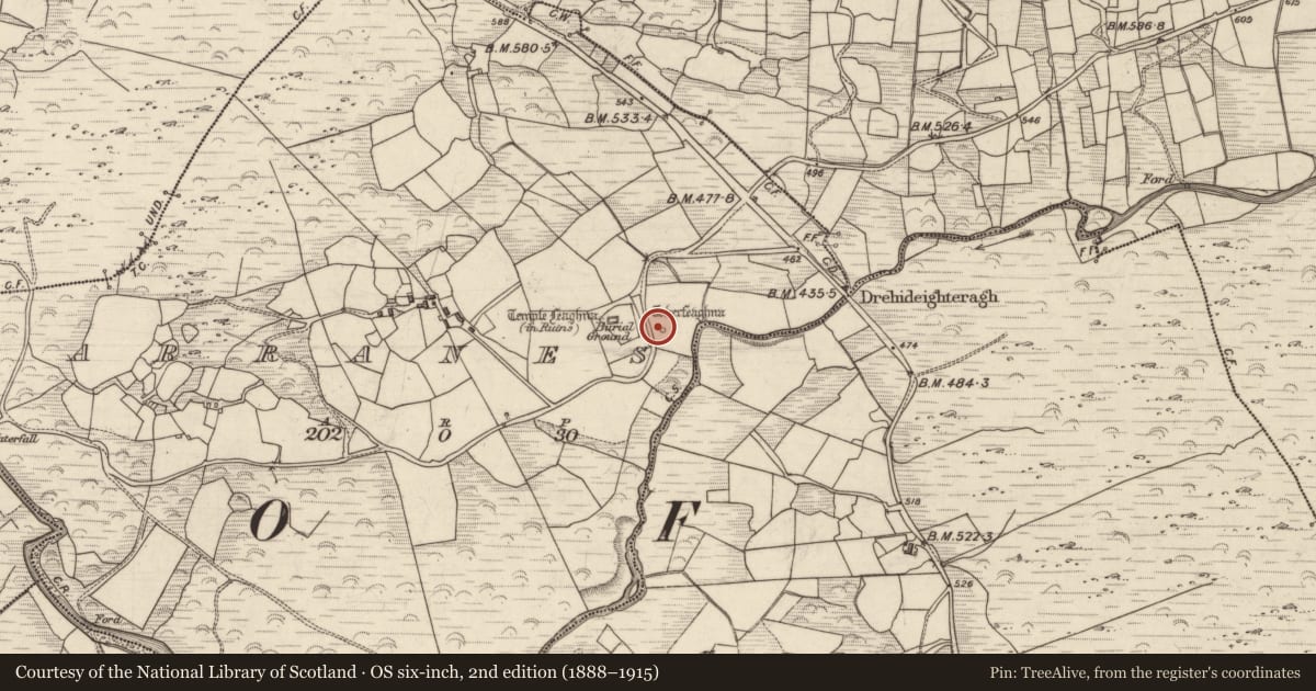
In pasture, on the lower S-facing slopes of Barrerneen. The ruins of Temple Feaghna (church of St. Fiachna)(KE102-038001-) stands in the N quadrant of a subrectangular-shaped burial ground (KE102-038001-) defined by an earthen bank which may have originally been constructed as the ecclesiastical enclosure (KE102-038----) of a monastery associated with St. Fiachna. A bullaun stone (KE102-038003-) lies c. 20m to the S and Toberfeaghna holy well (KE102-038004-) lies c. 50m to the E. A second bullaun stone (KE102-038005-), now in the roadside fence lies c. 50m to the N, and is said locally to have been formerly in the graveyard.
Toberfeaghna consists of a triangular-shaped well formed by two low stone slabs set against the base of the E face of an irregular-shaped upright boulder. Spring water from the well flows downslope to the SE. Pilgrims have inscribed a single cross (shaft L 0.2m; arms L 0.12m) on a stone slab (0.35m x 0.25m) which rests on top of the boulder. The well is overgrown with gorse bushes and small holly trees.
To see a 3D model of the stone visit https://skfb.ly/oyFEQ
Compiled by: Caimin O'Brien
Date of upload: 28 September 2022
Nearby in the register
- Ritual site - holy wellunder 1 mi
- Ecclesiastical enclosureunder 1 mi
- Children's burial groundunder 1 mi
- Graveyardunder 1 mi
Other entries of the same register within about three miles of this one, by straight line.