Sites and Monuments Record · Ireland
Ringfort - rath
Dromore (Dunkerron South By.), County Kerry, Ireland
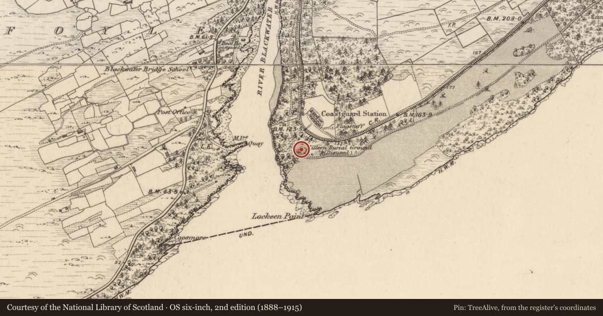
The record
- Townland
- Dromore (Dunkerron South By.)
- County
- Kerry
- Country
- Ireland
- Latest-edition OS map
- Not indicated
- Coordinates
- 51.85018, -9.74342
- SMR number
- KE101-001002-
Slide toward Today to fade the historical sheet and see the modern map underneath.
David Rumsey Map Collection, Stanford LibrariesDavid Rumsey Map Collection, Stanford LibrariesDavid Rumsey Map Collection, Stanford LibrariesDavid Rumsey Map Collection, Stanford Libraries
4 historical maps cover this location, the earliest the 1790 map "Composite: Ireland." (David Rumsey Map Collection, Stanford Libraries).
Historical maps covering this location
- 1790 · Composite: Ireland. (David Rumsey Map Collection, Stanford Libraries)
- 1868 · 4. Ireland. (David Rumsey Map Collection, Stanford Libraries)
- 1869 · Ireland. (David Rumsey Map Collection, Stanford Libraries)
- 1891 · Ireland 16 (David Rumsey Map Collection, Stanford Libraries)
This record in the National Monuments Service's Historic Environment Viewer ↗
The National Monuments Service's description
This severely disturbed site (KE101-001----), no longer in use by the late nineteenth century, is located in a forestry plantation on a SW slope overlooking the Blackwater river. The unenclosed burial area measures 20.7m N-S x 20.3m E-W. Trees have recently been planted within it. The site is bisected by a fire-prevention trench and a modern track skirts it at SW. It is otherwise covered in a layer of dense vegetation, which largely obscures the N-S rows of upright grave-markers which occur throughout the site.
The site is recorded in the OSNB as an 'old small fort which is a noted place for burying children' (Templeno, 45). It does not display any ringfort-type features, but an opening to a souterrain is located externally at SW.
The above description is derived from A. O'Sullivan and J. Sheehan (compilers), 'The Iveragh peninsula: an archaeological survey of South Kerry'. Cork University Press (1996), no. 999. In certain instances the entries have been revised and updated in the light of recent research.
Date of upload: 30 July 2013
Nearby in the register
- Children's burial groundunder 1 mi
- Souterrainunder 1 mi
- Ritual site - holy wellunder 1 mi
- Standing stone - pairunder 1 mi
Other entries of the same register within about three miles of this one, by straight line.