Sites and Monuments Record · Ireland
Children's burial ground
An Bhinn Bhán (Uíbh Ráthach), County Kerry, Ireland
The record
- Townland
- An Bhinn Bhán (Uíbh Ráthach)
- County
- Kerry
- Country
- Ireland
- First-edition OS map
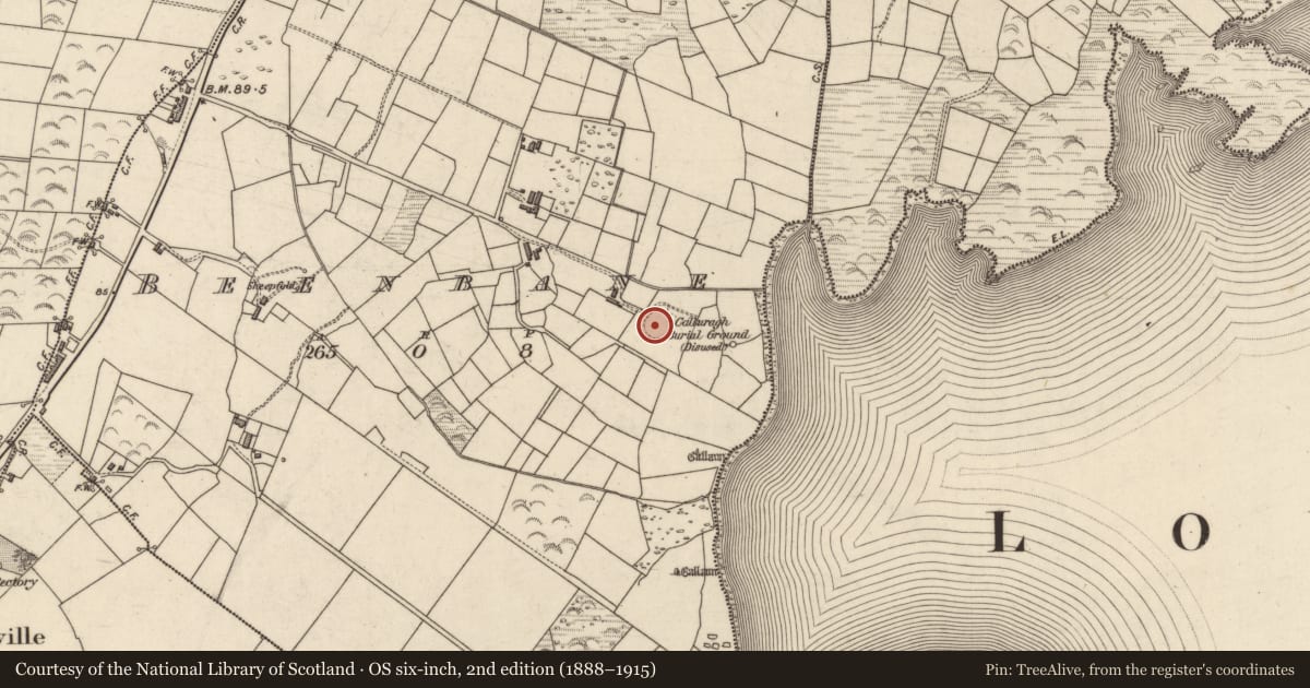
- Calluragh Burial Ground
- Latest-edition OS map
- Calluragh Burial Ground (Disused)
- Coordinates
- 51.83190, -10.15692
- SMR number
- KE098-029001-
Slide toward Today to fade the historical sheet and see the modern map underneath.
David Rumsey Map Collection, Stanford LibrariesDavid Rumsey Map Collection, Stanford LibrariesDavid Rumsey Map Collection, Stanford LibrariesDavid Rumsey Map Collection, Stanford Libraries
4 historical maps cover this location, the earliest the 1790 map "Composite: Ireland." (David Rumsey Map Collection, Stanford Libraries).
Historical maps covering this location
- 1790 · Composite: Ireland. (David Rumsey Map Collection, Stanford Libraries)
- 1841 · Ireland. (David Rumsey Map Collection, Stanford Libraries)
- 1869 · Ireland. (David Rumsey Map Collection, Stanford Libraries)
- 1891 · Ireland 16 (David Rumsey Map Collection, Stanford Libraries)
This record in the National Monuments Service's Historic Environment Viewer ↗
The National Monuments Service's description
National Monument No. 380. Calluragh Burial Ground (KE098-029001-): This site is located in poorly drained land, about 130m from the W shore of Lough Currane. It comprises a poorly preserved, subcircular enclosure containing a hut, a stone cross and a cross-inscribed slab. There is no visible trace of the souterrain (KE098-029005-) noted in the centre of the site by Henry (1957, 133). Numerous uninscribed grave-markers occur throughout the site and presumably relate to its use as a ceallúnach. These are particularly heavily concentrated in its S half.
The above description is derived from A. O'Sullivan and J. Sheehan (compilers), 'The Iveragh peninsula: an archaeological survey of South Kerry'. Cork University Press (1996), no. 931. In certain instances the entries have been revised and updated in the light of recent research.
Date of upload: 30 July 2013
References
Henry, F. 1957 Early Monasteries, Beehive Huts, and Dry-Stone Houses in the Neighbourhood of Caherciveen and Waterville (Co. Kerry). Proceedings of the Royal Irish Academy 58C, 45-166.
Nearby in the register
- Souterrainunder 1 mi
- Ecclesiastical enclosureunder 1 mi
- Crossunder 1 mi
- Cross-slabunder 1 mi
Other entries of the same register within about three miles of this one, by straight line.