Sites and Monuments Record · Ireland
Cross-slab
Ráth Ciaráin, County Kerry, Ireland
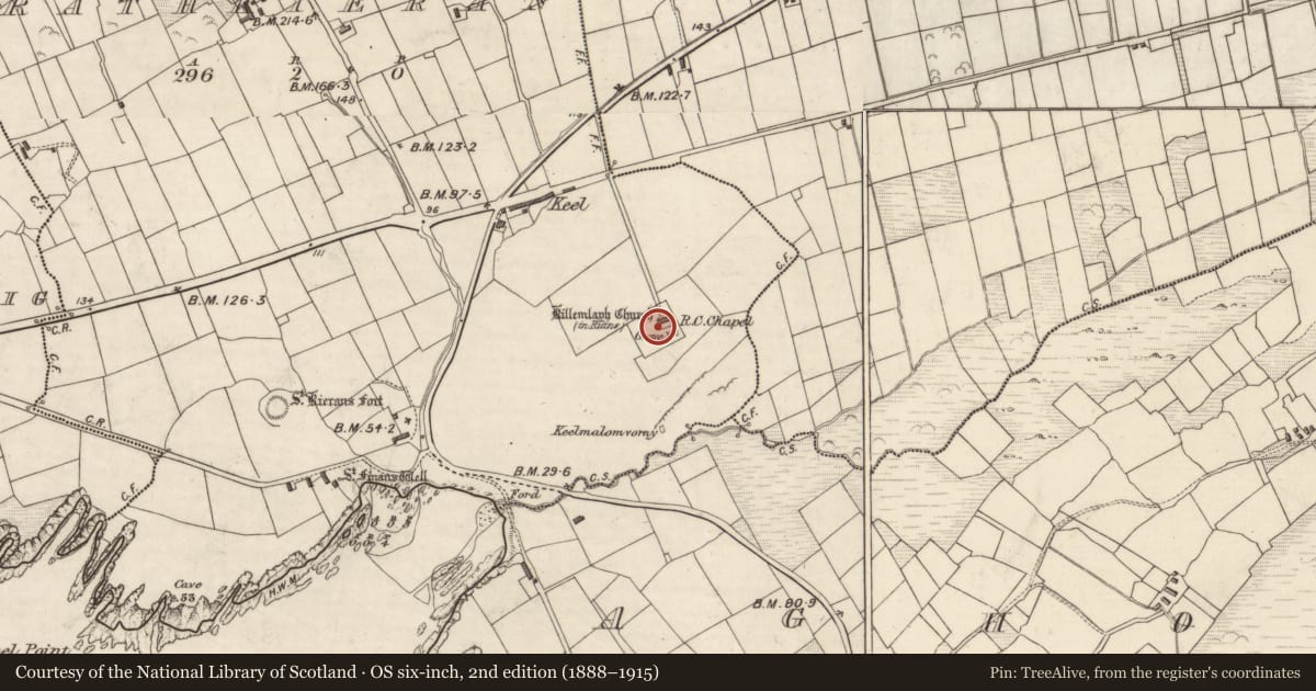
The record
- Townland
- Ráth Ciaráin
- County
- Kerry
- Country
- Ireland
- Latest-edition OS map
- Not indicated
- Coordinates
- 51.84815, -10.33217
- SMR number
- KE096-009002-
Slide toward Today to fade the historical sheet and see the modern map underneath.
David Rumsey Map Collection, Stanford LibrariesDavid Rumsey Map Collection, Stanford LibrariesDavid Rumsey Map Collection, Stanford LibrariesDavid Rumsey Map Collection, Stanford Libraries
4 historical maps cover this location, the earliest the 1753 map "Mappa geographica Regni Hiberniae" (David Rumsey Map Collection, Stanford Libraries).
Historical maps covering this location
- 1753 · Mappa geographica Regni Hiberniae (David Rumsey Map Collection, Stanford Libraries)
- 1841 · Ireland. (David Rumsey Map Collection, Stanford Libraries)
- 1869 · Ireland. (David Rumsey Map Collection, Stanford Libraries)
- 1891 · Ireland 16 (David Rumsey Map Collection, Stanford Libraries)
This record in the National Monuments Service's Historic Environment Viewer ↗
The National Monuments Service's description
Killemlagh Church / Cill Imleach: Located in a graveyard (KE096-009003-) directly above Keel Strand, in a valley known locally as The Glen. It overlooks St Finan's Bay and the Skelligs to W. It is traditionally associated with St Finan, as is a holy well located a short distance to W (KE096-007-----). This association, along with the presence of a possible ogham stone in the Medieval church's W gable, suggests that the site may occupy the location of an earlier ecclesiastical foundation. Rounds were formerly made here by people 'afflicted with diseases of a scrofulous nature' (Lynch 1902a, 61).
Cross-Inscribed Slab (KE096-009002-): This rectangular slab serves as the cover for a tomb located close to the W gable of the Medieval church. It measures 1.71m x .47m x .06m, and bears a plain linear cross at its S end.
The above description is derived from A. O'Sullivan and J. Sheehan (compilers), 'The Iveragh peninsula: an archaeological survey of South Kerry'. Cork University Press (1996), no. 1096. In certain instances the entries have been revised and updated in the light of recent research.
Date of upload: 31 July 2013
Nearby in the register
- Ogham stoneunder 1 mi
- Graveyardunder 1 mi
- Churchunder 1 mi
- Megalithic structureunder 1 mi
Other entries of the same register within about three miles of this one, by straight line.