Sites and Monuments Record · Ireland
Stone circle - multiple-stone
Gurteen (Glanarought By.), County Kerry, Ireland
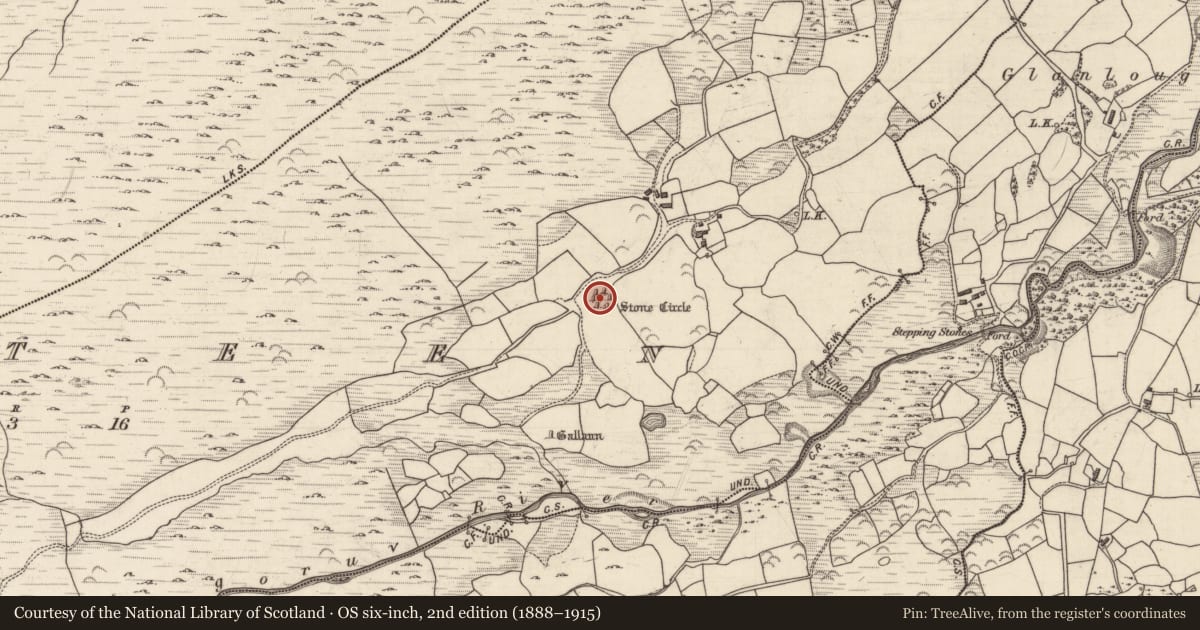
The record
- Townland
- Gurteen (Glanarought By.)
- County
- Kerry
- Country
- Ireland
- First-edition OS map
- Stone Circle
- Latest-edition OS map
- Stone Circle
- Coordinates
- 51.87221, -9.44525
- SMR number
- KE094-021001-
Slide toward Today to fade the historical sheet and see the modern map underneath.
David Rumsey Map Collection, Stanford LibrariesDavid Rumsey Map Collection, Stanford LibrariesDavid Rumsey Map Collection, Stanford LibrariesDavid Rumsey Map Collection, Stanford Libraries
4 historical maps cover this location, the earliest the 1790 map "Composite: Ireland." (David Rumsey Map Collection, Stanford Libraries).
Historical maps covering this location
- 1790 · Composite: Ireland. (David Rumsey Map Collection, Stanford Libraries)
- 1865 · Ireland, (South) Sheet. (David Rumsey Map Collection, Stanford Libraries)
- 1883 · Ireland 3. (David Rumsey Map Collection, Stanford Libraries)
- 1891 · Ireland 16 (David Rumsey Map Collection, Stanford Libraries)
This record in the National Monuments Service's Historic Environment Viewer ↗
The National Monuments Service's description
In rough pasture, to the N of the Glashagorour River and overlooked by a hillock to the S. This stone circle (diam. 10.5m) consists of eleven stones (L 0.6-2.8m; T 0.3-0.6m; H 0.7-1.5m), one of which is prostrate. Two further stones (H 1m and 0.75m), stand radially to the circumference of the circle and form a short entrance passage at NE. The axial stone is a fine regular slab with an internal bevel on its top surface and unusually, it is the largest stone of the circle. A boulder-burial (KE094-021002-) occupies the centre of the interior. A burnt spread (KE094-059----) lies c. 130m to the NNW and a cairn (KE094-058001-) is c. 350m to the W. (Ó Nualláin 1984a, 27, no. 43)
To see a 3D model of this monument visit: https://skfb.ly/6UYHV
The above description is derived from the published 'Archaeological Inventory of County Kerry. Volume I: South-West Kerry' (Dublin: Stationery Office, 2009). In certain instances the entries have been revised and updated in the light of recent research.
Date of upload: 30 May 2011
References
Ó Nualláin, S. 1984a A survey of stone circles in Cork and Kerry. Proceedings of the Royal Irish Academy 84C, 1-77.
Nearby in the register
- Boulder-burialunder 1 mi
- Burnt spreadunder 1 mi
- Fulacht fiaunder 1 mi
- Standing stoneunder 1 mi
Other entries of the same register within about three miles of this one, by straight line.