Sites and Monuments Record · Ireland
Stone circle - multiple-stone
Killowen, County Kerry, Ireland
The record
- Townland
- Killowen
- County
- Kerry
- Country
- Ireland
- First-edition OS map
- NULL
- Latest-edition OS map
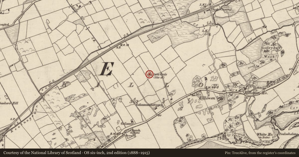
- Stone Circle (Site of)
- Coordinates
- 51.88706, -9.56663
- SMR number
- KE093-018----
Slide toward Today to fade the historical sheet and see the modern map underneath.
David Rumsey Map Collection, Stanford LibrariesDavid Rumsey Map Collection, Stanford LibrariesDavid Rumsey Map Collection, Stanford LibrariesDavid Rumsey Map Collection, Stanford Libraries
4 historical maps cover this location, the earliest the 1790 map "Composite: Ireland." (David Rumsey Map Collection, Stanford Libraries).
Historical maps covering this location
- 1790 · Composite: Ireland. (David Rumsey Map Collection, Stanford Libraries)
- 1865 · Ireland, (South) Sheet. (David Rumsey Map Collection, Stanford Libraries)
- 1869 · Ireland. (David Rumsey Map Collection, Stanford Libraries)
- 1891 · Ireland 16 (David Rumsey Map Collection, Stanford Libraries)
This record in the National Monuments Service's Historic Environment Viewer ↗
The National Monuments Service's description
In level pasture, to the N of Kenmare Bay. There are no visible remains of this stone circle. It was indicated as a circle of stones (diam. c. 10m), enclosing a central stone, on the 1846 OS 6-inch map. A sketch of it from the 1842 OS Memoranda, County Kerry, reproduced by Ó Nualláin (1984a, 63, fig. 12) depicts a circle of eleven stones surrounding a central stone, which appears to have had a cupmark on its upper surface. The caption on the sketch reads: 'An ancient circle of gallauns varying from 2 to 3 feet [0.6-0.91m] high and some lying prostrate' (ibid.). Ó Nualláin (1975, 86) suggests that the central stone may have been the capstone of a boulder-burial (KE093-018001-). (Ó Nualláin 1984a, 26, no. 40)
The above description is derived from the published 'Archaeological Inventory of County Kerry. Volume I: South-West Kerry' (Dublin: Stationery Office, 2009). In certain instances the entries have been revised and updated in the light of recent research.
Date of upload: 30 May 2011
Nearby in the register
- Boulder-burialunder 1 mi
- Standing stoneunder 1 mi
- Souterrainunder 1 mi
- Ringfort - rathunder 1 mi
Other entries of the same register within about three miles of this one, by straight line.