Sites and Monuments Record · Ireland
Leacht
Ceann Eich, County Kerry, Ireland
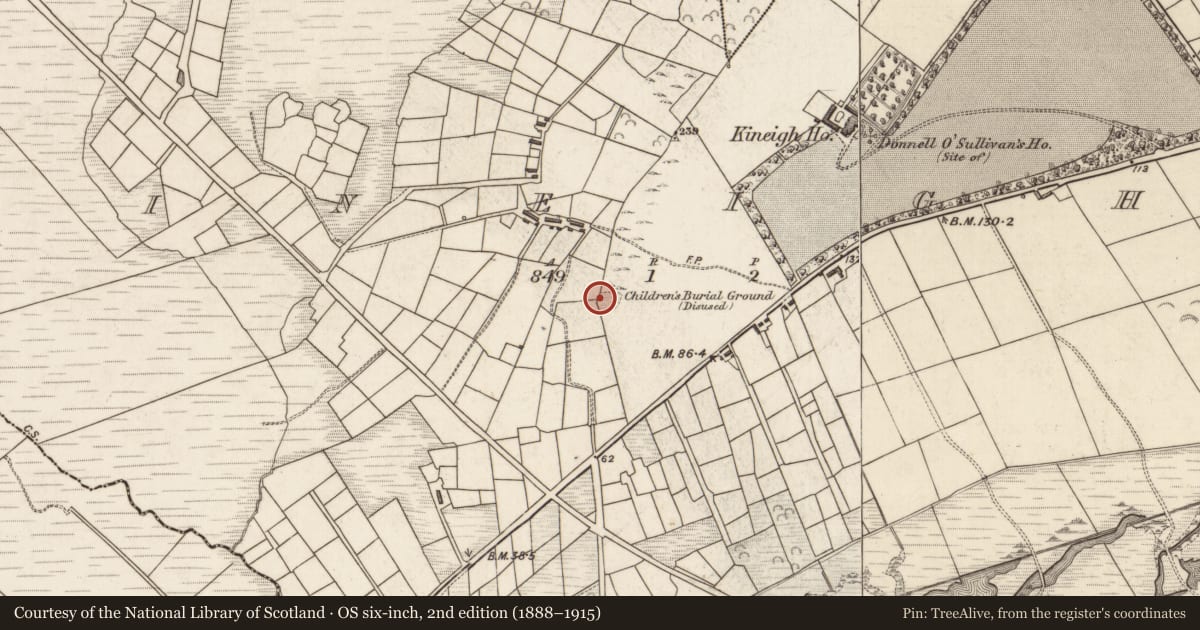
The record
- Townland
- Ceann Eich
- County
- Kerry
- Country
- Ireland
- Latest-edition OS map
- Not indicated
- Coordinates
- 51.86190, -10.19230
- SMR number
- KE088-033001-
Slide toward Today to fade the historical sheet and see the modern map underneath.
David Rumsey Map Collection, Stanford LibrariesDavid Rumsey Map Collection, Stanford LibrariesDavid Rumsey Map Collection, Stanford LibrariesDavid Rumsey Map Collection, Stanford Libraries
4 historical maps cover this location, the earliest the 1790 map "Composite: Ireland." (David Rumsey Map Collection, Stanford Libraries).
Historical maps covering this location
- 1790 · Composite: Ireland. (David Rumsey Map Collection, Stanford Libraries)
- 1841 · Ireland. (David Rumsey Map Collection, Stanford Libraries)
- 1869 · Ireland. (David Rumsey Map Collection, Stanford Libraries)
- 1891 · Ireland 16 (David Rumsey Map Collection, Stanford Libraries)
This record in the National Monuments Service's Historic Environment Viewer ↗
The National Monuments Service's description
Children's Burial Ground KE088-033----, abutting a field boundary at W, this site is located in rough pasture and overlooks the estuary of the Inny river at S. It is oval-shaped in plan, with overall dimensions of 29m N-S x 34m E-W, and is defined at E and S by a poorly preserved earth and stone bank, which measures .6m high and 3.5m wide.
The overgrown interior slopes down to S, where most of the grave-markers are concentrated. A large number of these markers are now prostrate, but those still standing are generally aligned N-S.
Centrally located is a leacht-type feature (KE088-033001-), which is constructed of coursed drystone masonry intermixed with a large quantity of quartz stones. It is rectangular in outline and measures 3.2m N-S x 2.45m E-W. An irregular mound of loose stones occurs 1.2m to SE. Occurring in the SE quadrant, close to the edge of the site, is a large prostrate slab; 1.6m x .4m x .35m thick.
The above description is derived from A. O'Sullivan and J. Sheehan (compilers), 'The Iveragh peninsula: an archaeological survey of South Kerry'. Cork University Press (1996), no. 1032. In certain instances the entries have been revised and updated in the light of recent research.
Date of upload: 30 July 2013
Nearby in the register
- Children's burial groundunder 1 mi
- Megalithic tomb - unclassifiedunder 1 mi
- Enclosureunder 1 mi
- Ringfort - rathunder 1 mi
Other entries of the same register within about three miles of this one, by straight line.