Sites and Monuments Record · Ireland
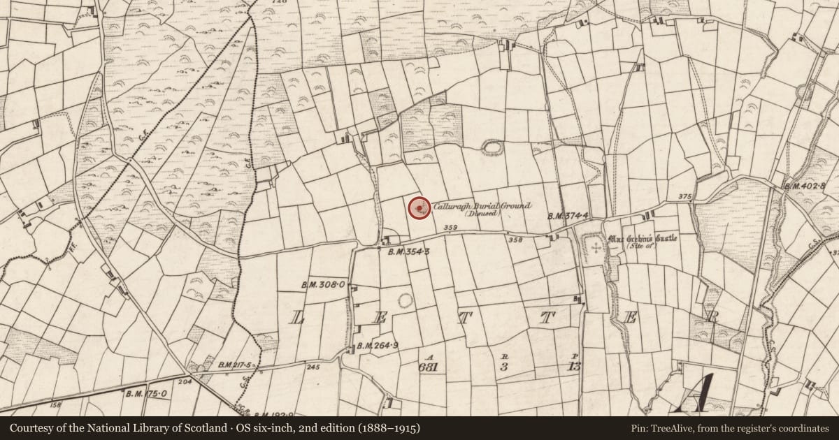
Children's burial ground
Letter (Iveragh By.), County Kerry, Ireland
The record
- Townland
- Letter (Iveragh By.)
- County
- Kerry
- Country
- Ireland
- Latest-edition OS map
- Calluragh Burial Ground (Disused)
- Coordinates
- 51.92559, -10.22453
- SMR number
- KE079-065001-
Slide toward Today to fade the historical sheet and see the modern map underneath.
David Rumsey Map Collection, Stanford LibrariesDavid Rumsey Map Collection, Stanford LibrariesDavid Rumsey Map Collection, Stanford LibrariesDavid Rumsey Map Collection, Stanford Libraries
4 historical maps cover this location, the earliest the 1790 map "Composite: Ireland." (David Rumsey Map Collection, Stanford Libraries).
Historical maps covering this location
- 1790 · Composite: Ireland. (David Rumsey Map Collection, Stanford Libraries)
- 1841 · Ireland. (David Rumsey Map Collection, Stanford Libraries)
- 1869 · Ireland. (David Rumsey Map Collection, Stanford Libraries)
- 1891 · Ireland 16 (David Rumsey Map Collection, Stanford Libraries)
This record in the National Monuments Service's Historic Environment Viewer ↗
The National Monuments Service's description
Calluragh Burial Ground (KE079-065001-): This site is located in rough pasture on the S facing slope of the spur which runs W from Bentee mountain. It consists of an oval platform, measuring 17.7m N-S x 25m E-W, on which an ogham stone, two possible leachta and a burial area are located. The platform reaches a maximum height of 2.8m at S, where a possible entrance survives as a recessed area flanked on one side by an upright pillar. The original limits of the site may be preserved in a curving field boundary at E.
The burial area occupies the W portion of the platform, which features a large number of uninscribed slabs that stand up to .6m high. The site continued to be used as a ceallúnach until the 1930s (local information).
The above description is derived from A. O'Sullivan and J. Sheehan (compilers), 'The Iveragh peninsula: an archaeological survey of South Kerry'. Cork University Press (1996), no. 962. In certain instances the entries have been revised and updated in the light of recent research.
Date of upload: 30 July 2013
Nearby in the register
- Ecclesiastical enclosureunder 1 mi
- Leachtunder 1 mi
- Leachtunder 1 mi
- Ogham stoneunder 1 mi
Other entries of the same register within about three miles of this one, by straight line.