Sites and Monuments Record · Ireland
Rock art
Kealduff Upper, County Kerry, Ireland
The record
- Townland
- Kealduff Upper
- County
- Kerry
- Country
- Ireland
- Coordinates
- 52.01225, -10.00301
- SMR number
- KE071-090----
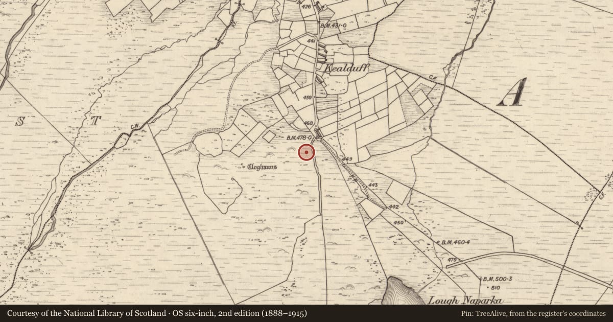
Slide toward Today to fade the historical sheet and see the modern map underneath.
David Rumsey Map Collection, Stanford LibrariesDavid Rumsey Map Collection, Stanford LibrariesDavid Rumsey Map Collection, Stanford LibrariesDavid Rumsey Map Collection, Stanford Libraries
4 historical maps cover this location, the earliest the 1753 map "Mappa geographica Regni Hiberniae" (David Rumsey Map Collection, Stanford Libraries).
Historical maps covering this location
- 1753 · Mappa geographica Regni Hiberniae (David Rumsey Map Collection, Stanford Libraries)
- 1790 · Composite: Ireland. (David Rumsey Map Collection, Stanford Libraries)
- 1869 · Ireland. (David Rumsey Map Collection, Stanford Libraries)
- 1891 · Ireland 16 (David Rumsey Map Collection, Stanford Libraries)
This record in the National Monuments Service's Historic Environment Viewer ↗
The National Monuments Service's description
In mountain heath (151m OD), with a concentration of rock outcrop and boulders, on a general NE-facing slope. An expanse of rock outcrop which is sod covered on two sides, to W and N of the decorated surface and is also covered by some sod, sphagnum moss and water on its S side. A smooth and fractured expanse of sandstone (dims. 1.85m E-W; 1.5m N-S; H 0.2m) is exposed between sod covered areas and has an irregular-shaped decorated surface (dims. 1.3m E-W, 1.2m N-S) which has a gentle S-facing aspect. All of the exposed motifs are defined by pickmarks and located across the southern margin of the exposed area of this rock. A cup-and-ring motif (overall diam. 16cm; cup diam. 7cm; D 6mm; ring Wth 1cm; D 3mm) enclosed by a partial ring SW->W->NE, is located at W-end of decorated surface; two naturally formed fractures are adjacent to W. A cup-and-two-ring motif (overall dims. 26cm N-S; 23cm E-W; cup diam. 7cm; D 6mm; ring Wth 1-1.5cm; D 4mm) is located centrally upon decorated surface, 15cm to E of latter; The ring is open to E, however this may be a result of exposure to freeze-thaw action. A radial groove (dims. L 15cm; Wth 1.5-2cm) extends from cupmark to E and continues beyond the motif. A cup-and-two-ring motif (overall diam. 27cm; cup diam. 6cm; D 4mm; ring Wth 1cm; D 2-3mm), c. 28cm to SE of latter, forms E-end of decorated surface. A short portion of radial groove extends from middle ring to just beyond outer ring, at SE. This motif is enclosed by a line of pickmarks which respect the outer ring W->NW and terminate in a circular cluster of pickmarks at the N end, which may have been an intended cupmark. A number of similar characteristics to rock art (KE071-035----), c. 25m to S, may suggest that this (KE071-090----) is a duplicate site.
Compiled by: Alison McQueen and Vera Rahilly
Date of upload: 5 July 2017
Nearby in the register
Other entries of the same register within about three miles of this one, by straight line.