Sites and Monuments Record · Ireland
Church
Kilkneedan, County Kerry, Ireland
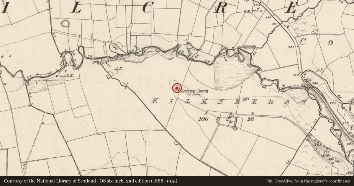
The record
- Townland
- Kilkneedan
- County
- Kerry
- Country
- Ireland
- Latest-edition OS map
- Kilcredane Church (in Ruins)
- Coordinates
- 52.12847, -9.54882
- SMR number
- KE058-015001-
Slide toward Today to fade the historical sheet and see the modern map underneath.
David Rumsey Map Collection, Stanford LibrariesDavid Rumsey Map Collection, Stanford LibrariesDavid Rumsey Map Collection, Stanford LibrariesDavid Rumsey Map Collection, Stanford Libraries
4 historical maps cover this location, the earliest the 1790 map "Composite: Ireland." (David Rumsey Map Collection, Stanford Libraries).
Historical maps covering this location
- 1790 · Composite: Ireland. (David Rumsey Map Collection, Stanford Libraries)
- 1841 · Ireland. (David Rumsey Map Collection, Stanford Libraries)
- 1869 · Ireland. (David Rumsey Map Collection, Stanford Libraries)
- 1891 · Ireland 16 (David Rumsey Map Collection, Stanford Libraries)
This record in the National Monuments Service's Historic Environment Viewer ↗
The National Monuments Service's description
In pasture, on top of a ridge. The collapsed remains of a two-phase church. The remains consist of the low loose rubble limestone walls (H c 0.6m) of the E end of the church (int. 7.4m N-S; 3.76m E-W) with the upstanding remains of the N and S wall (H c. 2.5m; L c. 3m) at the W end. The low walls of a slightly wider addition to W (9.55m E-W; 6.7m N-S) give the church a nave and chancel layout. The remains of the upstanding S wall at the E end butts onto and overlaps the external wall of the earlier church by c. 1m. There is a splayed window ope embrasure at the E end of the S wall. The level interior is overgrown at the E end with lots of loose rubble stones scattered about. During a subsequent inspection in 2003, it was noted that the wall to the W of the window embrasure had collapsed. According to local information, there was an altar at the E end. There is a children's burial ground (KE058-015----) in the immediate vicinity of the church.
Compiled by: Elizabeth Byrne, Ursula Egan and Sheila Ronan, Archaeological Survey Unit, University College, Cork.
Date of upload: 31 January 2011
Nearby in the register
- Children's burial groundunder 1 mi
- Ecclesiastical enclosureunder 1 mi
- Barrow - unclassifiedunder 1 mi
- Enclosureunder 1 mi
Other entries of the same register within about three miles of this one, by straight line.