Sites and Monuments Record · Ireland
Ogham stone
Baile An Tsagairt (TC Na Gleannta), County Kerry, Ireland
The record
- Townland
- Baile An Tsagairt (TC Na Gleannta)
- County
- Kerry
- Country
- Ireland
- First-edition OS map
- Not indicated
- Latest-edition OS map
- Not indicated
- Coordinates
- 52.12773, -10.24325
- SMR number
- KE053-033014-
Slide toward Today to fade the historical sheet and see the modern map underneath.
David Rumsey Map Collection, Stanford LibrariesDavid Rumsey Map Collection, Stanford LibrariesDavid Rumsey Map Collection, Stanford LibrariesDavid Rumsey Map Collection, Stanford Libraries
4 historical maps cover this location, the earliest the 1790 map "Composite: Ireland." (David Rumsey Map Collection, Stanford Libraries).
Historical maps covering this location
- 1790 · Composite: Ireland. (David Rumsey Map Collection, Stanford Libraries)
- 1841 · Ireland. (David Rumsey Map Collection, Stanford Libraries)
- 1869 · Ireland. (David Rumsey Map Collection, Stanford Libraries)
- 1891 · Ireland 16 (David Rumsey Map Collection, Stanford Libraries)
This record in the National Monuments Service's Historic Environment Viewer ↗
The National Monuments Service's description
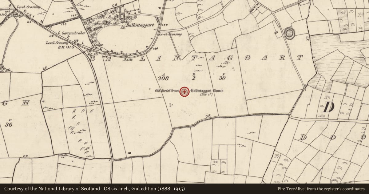
Ballintaggart church (KE053-033001-) (site of) and old burial ground (KE053-033002-) /An Cheallúnach or An Lisín: This circular enclosure crowns the summit of a low, but prominent, hillock between Dingle Harbour and Trabeg (Cuppage 1986, no. 820). Macalister (1945, 151-7) recorded nine ogham stones collected together at the site. These 'mostly pulvinar' or oval water-rolled boulders resemble the stones found 'about 6 miles away' at Minard storm beach. Eight of the nine stones are now arranged in a circle within the stone enclosure with the ninth placed centrally. A tenth ogham stone was discovered in the 1980's but only protrudes 24cm above the ground (Devane 2001, 369).
Compiled by: Paul Walsh
Date of upload: 31 December 2014
References
Devane, C. 2001 An ogam-inscribed stone in Ballintaggart. Peritia 15, 369-72.
Macalister, R.A.S. 1945 Corpus inscriptionum insularum celticarum. Dublin. Stationery Office.
Cuppage, J. 1986 Corca Dhuibhne. Dingle Peninsula archaeological survey. Ballyferriter. Oidhreacht Chorca Dhuibhne.
Nearby in the register
- Graveyardunder 1 mi
- Ogham stone (present location)under 1 mi
- Ogham stone (present location)under 1 mi
- Ogham stone (present location)under 1 mi
Other entries of the same register within about three miles of this one, by straight line.