Sites and Monuments Record · Ireland
Castle - unclassified
Castlefarm, County Kerry, Ireland
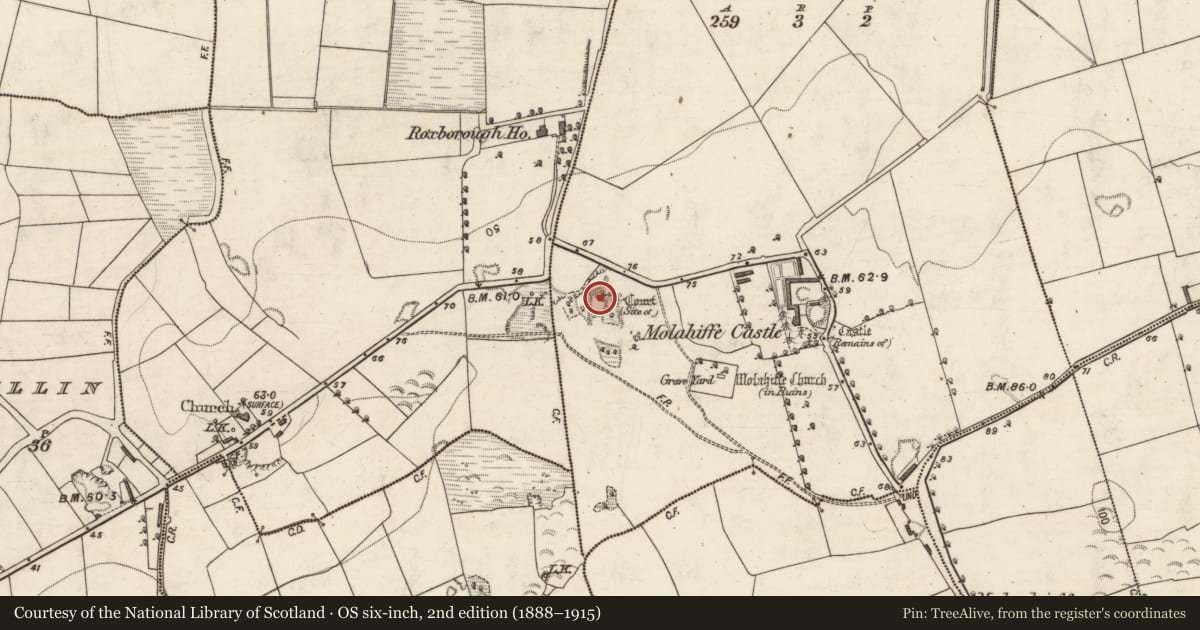
The record
- Townland
- Castlefarm
- County
- Kerry
- Country
- Ireland
- First-edition OS map
- Site of Court (1846)
- Latest-edition OS map
- Court (Site of)
- Coordinates
- 52.18274, -9.59742
- SMR number
- KE048-035001-
Slide toward Today to fade the historical sheet and see the modern map underneath.
David Rumsey Map Collection, Stanford LibrariesDavid Rumsey Map Collection, Stanford LibrariesDavid Rumsey Map Collection, Stanford LibrariesDavid Rumsey Map Collection, Stanford Libraries
4 historical maps cover this location, the earliest the 1790 map "Composite: Ireland." (David Rumsey Map Collection, Stanford Libraries).
Historical maps covering this location
- 1790 · Composite: Ireland. (David Rumsey Map Collection, Stanford Libraries)
- 1841 · Ireland. (David Rumsey Map Collection, Stanford Libraries)
- 1869 · Ireland. (David Rumsey Map Collection, Stanford Libraries)
- 1891 · Ireland 16 (David Rumsey Map Collection, Stanford Libraries)
This record in the National Monuments Service's Historic Environment Viewer ↗
The National Monuments Service's description
On top of an elevated limestone outcrop partially covered by deciduous trees and strewn by loose moss-covered stones. The top edge of the outcrop is defined intermittently along its N (L c. 25m) and W (L c. 40m) sides by a linear bank (Wth c. 1.5m; H 0.5m) (KE048-035002-); the site is depicted by a dotted line enclosing a roughly rectangular area (c. 60m N-S; c. 50m E-W) on the 1840 OS 6-inch map. In the centre of the area defined by the bank is the remains of a rectangular structure (8.8m N-S; 8.4m E-W) defined by the basal courses of a random-rubble wall (T 0.85m; H 0.5m) bonded by a lime mortar. The exact nature of the monument is unclear but the name 'Court' suggests it may be the remains of a late-16th/early 17th-century fortified residence.
Compiled by: Elizabeth Byrne, Ursula Egan and Sheila Ronan, Archaeological Survey Unit, University College, Cork.
Date of upload: 31 January 2011
This monument is subject to a preservation order made under the National Monuments Acts 1930 to 2014 (PO no. 41/1976).
Nearby in the register
- Earthworkunder 1 mi
- Graveyardunder 1 mi
- Churchunder 1 mi
- Country houseunder 1 mi
Other entries of the same register within about three miles of this one, by straight line.