Sites and Monuments Record · Ireland
Ritual site - holy well
Coolgarriv (Trughanacmy By.), County Kerry, Ireland
The record
- Townland
- Coolgarriv (Trughanacmy By.)
- County
- Kerry
- Country
- Ireland
- First-edition OS map
- Indicated
- Latest-edition OS map
- Outlined
- Coordinates
- 52.24868, -9.53468
- SMR number
- KE039-149----
Slide toward Today to fade the historical sheet and see the modern map underneath.
David Rumsey Map Collection, Stanford LibrariesDavid Rumsey Map Collection, Stanford LibrariesDavid Rumsey Map Collection, Stanford LibrariesDavid Rumsey Map Collection, Stanford Libraries
4 historical maps cover this location, the earliest the 1790 map "Composite: Ireland." (David Rumsey Map Collection, Stanford Libraries).
Historical maps covering this location
- 1790 · Composite: Ireland. (David Rumsey Map Collection, Stanford Libraries)
- 1841 · Ireland. (David Rumsey Map Collection, Stanford Libraries)
- 1869 · Ireland. (David Rumsey Map Collection, Stanford Libraries)
- 1891 · Ireland 16 (David Rumsey Map Collection, Stanford Libraries)
This record in the National Monuments Service's Historic Environment Viewer ↗
The National Monuments Service's description
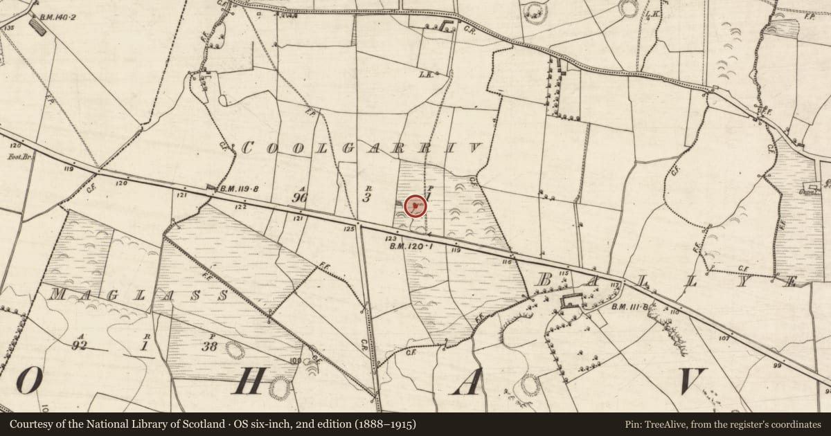
Holy well known locally as "Tobar na Coróine" (Rosary Well) was described by O'Hare (2000, 64) as; 'Both the IFC S (443:62) and Ó Danachair (op. cit. 163) record the presence of a well known as Tobar Na Coróine (Rosary Well) in the townland of Ballyegan. However, it appears likely that the well referred to is actually that located in a wet marshy field in the south portion of the neighbouring townland of Coolgarriv. The well is untitled on both editions of the OS maps.
This well is now encased in concrete and is said to supply the domestic needs of Woodville House. Ó Danachair found no memory of any devotions connected with Tobar na Coróine and considered it unlikely to have been a holy well (op. cit., 163). However, the IFCS does record that a Mrs Jude O'Connor (1846-1926) of Maglass had heard that at one time rounds were made at the well, although she herself had never seen them being made. A large fulacht fiadh is situated immediately to the south of the well. The remains of the ruined Nohoval church and graveyard, which are situated within a large, possible early church enclosure, are located a short
distance to the east'.
Folklore collected from Ballymacelligott School recorded the following tradition about this well; 'At Baile Uí Aodhagáin in Jerry O'Connor's is "Tobar na Coróine" ( Rosary Well). Mrs Jude O'Connor (1846-1926) of Maglass heard there used be rounds made there but never saw them made' (The Schools’ Collection, Volume 0443, Page 062; https://www.duchas.ie/en/cbes/4706340/4704131/4783810?ChapterID=4706340).
Compiled by: Caimin O'Brien
Date of upload: 28 April 2022
References
O'Hare, P. 2000 Holy wells and other sites of pilgrimage within a portion of East Kerry. Journal of the Kerry Archaeological and Historical Society 29, 55-98.
Ó Danachair, C. 1958 The Holy Wells of North County Kerry. Journal of the Royal Society of Antiquaries of Ireland 88, 153-63.
Nearby in the register
- Fulacht fiaunder 1 mi
- Enclosureunder 1 mi
- Fulacht fiaunder 1 mi
- Ringfort - rathunder 1 mi
Other entries of the same register within about three miles of this one, by straight line.