Sites and Monuments Record · Ireland
Rock art
Baile Uí Uaithnín, County Kerry, Ireland
The record
- Townland
- Baile Uí Uaithnín
- County
- Kerry
- Country
- Ireland
- Coordinates
- 52.19899, -10.14777
- SMR number
- KE035-162----
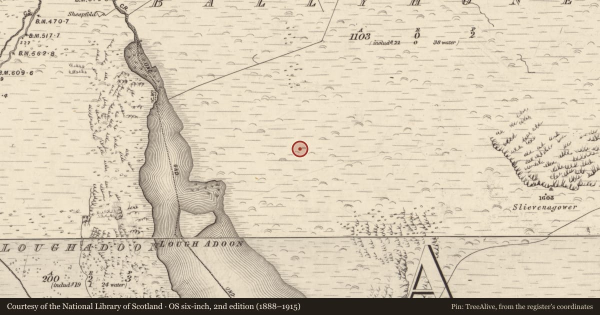
Slide toward Today to fade the historical sheet and see the modern map underneath.
David Rumsey Map Collection, Stanford LibrariesDavid Rumsey Map Collection, Stanford LibrariesDavid Rumsey Map Collection, Stanford LibrariesDavid Rumsey Map Collection, Stanford Libraries
4 historical maps cover this location, the earliest the 1790 map "Composite: Ireland." (David Rumsey Map Collection, Stanford Libraries).
Historical maps covering this location
- 1790 · Composite: Ireland. (David Rumsey Map Collection, Stanford Libraries)
- 1841 · Ireland. (David Rumsey Map Collection, Stanford Libraries)
- 1869 · Ireland. (David Rumsey Map Collection, Stanford Libraries)
- 1891 · Ireland 16 (David Rumsey Map Collection, Stanford Libraries)
This record in the National Monuments Service's Historic Environment Viewer ↗
The National Monuments Service's description
In mountain heath (167m OD), on a SSW-facing slope, with commanding views over Lough Adoon S->W->NW. A smooth and unfractured sandstone boulder (dims. 1.85m ENE-WSW; 1.10m NNW-SSE; H 0.45m) which is irregular in plan and protrudes from hillside with a slight overhang at WSW. It has a generally level decorated surface (dims. 0.5m ENE-WSW; 0.5m NNW-SSE) which has a very slight W-facing aspect toward Lough Adoon. The decorative elements are faint due to weathering in this exposed location. A small cup-and-ring motif (overall diam. 7.5cm; ring Wth 1.5cm; ring D 2-3mm; cup diam. 2.5-3cm; cup D 7mm) is located centrally upon the decorated surface. A small heart-shaped ring (dims. 6cm x 7cm; ring Wth 1cm; ring D 3mm) is adjacent to NW. A minimum of four cupmarks ranging from the smallest (diam. 2.5cm; D 3mm) to the largest (diam. 5cm; D 8mm) are located to E, SE and SW. A cluster (dims. 5cm; 4.5cm E-W) of approximately twelve pickmarks (diam. 3mm; D 1-1.5mm) is further to NW. Rock art (KE035-119----) is c. 90.5m to SW.
Compiled by: Alison McQueen and Vera Rahilly
Date of upload: 17 July 2017
Nearby in the register
- Fulacht fiaunder 1 mi
- Fulacht fiaunder 1 mi
- Hut siteunder 1 mi
- Hut siteunder 1 mi
Other entries of the same register within about three miles of this one, by straight line.