Sites and Monuments Record · Ireland
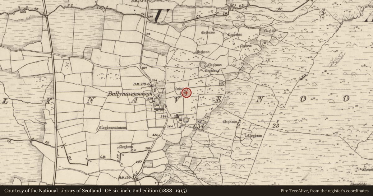
Clochan
Baile Na Bhfionnúrach, County Kerry, Ireland
The record
- Townland
- Baile Na Bhfionnúrach
- County
- Kerry
- Country
- Ireland
- Latest-edition OS map
- Not indicated
- Coordinates
- 52.22618, -10.29792
- SMR number
- KE034-041004-
Slide toward Today to fade the historical sheet and see the modern map underneath.
David Rumsey Map Collection, Stanford LibrariesDavid Rumsey Map Collection, Stanford LibrariesDavid Rumsey Map Collection, Stanford LibrariesDavid Rumsey Map Collection, Stanford Libraries
4 historical maps cover this location, the earliest the 1753 map "Mappa geographica Regni Hiberniae" (David Rumsey Map Collection, Stanford Libraries).
Historical maps covering this location
- 1753 · Mappa geographica Regni Hiberniae (David Rumsey Map Collection, Stanford Libraries)
- 1841 · Ireland. (David Rumsey Map Collection, Stanford Libraries)
- 1869 · Ireland. (David Rumsey Map Collection, Stanford Libraries)
- 1891 · Ireland 16 (David Rumsey Map Collection, Stanford Libraries)
This record in the National Monuments Service's Historic Environment Viewer ↗
The National Monuments Service's description
'To the east of the cashel [KE034-041----], immediately south of the entrance, are the remains of three cloghauns [KE034-041003-, KE034-041004-, KE034-041005-] roughly in a row, two are conjoined in a figure of eight. A direct relationship between the cloughans and the cashel cannot be discounted' (Gibbons 1998, 81).
Reference: Gibbons E. 1998 'Cathair Fionnuragh (Cathair a bhoghasin), Ballynavenooragh' in I. Bennett (ed.) Excavations 1997: summary accounts of archaeological excavations in Ireland. p. 80-81.
Date of upload/revision: 4 December 2017
Nearby in the register
- Clochanunder 1 mi
- Clochanunder 1 mi
- Souterrainunder 1 mi
- Hut siteunder 1 mi
Other entries of the same register within about three miles of this one, by straight line.