Sites and Monuments Record · Ireland
House - fortified house
Castlereban North, County Kildare, Ireland
The record
- Townland
- Castlereban North
- County
- Kildare
- Country
- Ireland
- First-edition OS map
- Indicated
- Latest-edition OS map
- Indicated
- Coordinates
- 53.03028, -7.03525
- SMR number
- KD030-008001-
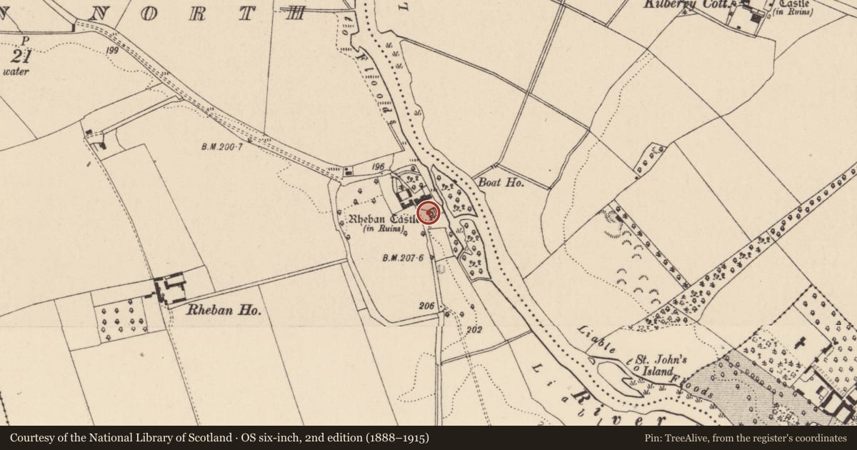
Slide toward Today to fade the historical sheet and see the modern map underneath.
David Rumsey Map Collection, Stanford LibrariesDavid Rumsey Map Collection, Stanford LibrariesDavid Rumsey Map Collection, Stanford LibrariesDavid Rumsey Map Collection, Stanford Libraries
4 historical maps cover this location, the earliest the 1790 map "Composite: Ireland." (David Rumsey Map Collection, Stanford Libraries).
Historical maps covering this location
- 1790 · Composite: Ireland. (David Rumsey Map Collection, Stanford Libraries)
- 1799 · Ireland. (David Rumsey Map Collection, Stanford Libraries)
- 1869 · Ireland. (David Rumsey Map Collection, Stanford Libraries)
- 1891 · Ireland 16 (David Rumsey Map Collection, Stanford Libraries)
This record in the National Monuments Service's Historic Environment Viewer ↗
The National Monuments Service's description
Incorporated into an earlier castle (KD030-008----), the ivy-clad S end (S and W walls) of a 17th-fortified house project W from the SW angle of the earlier structure. The S wall (L 5.8m E-W) survives to three stories (and extends E over the S wall of the castle) with large hood-moulded, mullioned and transommed windows on each floor, while the three-storied W wall (L 5.2m N-S) is reduced to one story at its present N end where a modern N wall is inserted to make a lean-to shed, with a large double-door at the S end of the W wall, which is inaccessible. A later (18th/19th-century?), single-storied, rectangular building (ext. dims. L 14.2m E-W; Wth 6.2m N-S; wall T 1m) abuts the S end of the castle and has a doorway in the S wall and a modern double-doorway in the W wall, above which is a carved stone bearing a jolly-looking, wigged creature. Traces of a fosse c. 40m to WSW noted in 1987 (SMR file) are no longer visible at ground-level.
Compiled by: Gearóid Conroy
Date of upload: 30 September 2013
Nearby in the register
- Castle - Anglo-Norman masonry castleunder 1 mi
- Ringfort - rathunder 1 mi
- Religious house - Knights Hospitallersunder 1 mi
- Ring-ditchunder 1 mi
Other entries of the same register within about three miles of this one, by straight line.