Sites and Monuments Record · Ireland
Castle - unclassified
Kilberry, County Kildare, Ireland
The record
- Townland
- Kilberry
- County
- Kildare
- Country
- Ireland
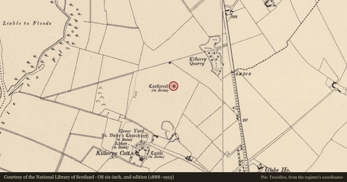
- First-edition OS map
- Castlerady
- Latest-edition OS map
- Castleready (in Ruins)
- Coordinates
- 53.03707, -7.02302
- SMR number
- KD030-004001-
Slide toward Today to fade the historical sheet and see the modern map underneath.
David Rumsey Map Collection, Stanford LibrariesDavid Rumsey Map Collection, Stanford LibrariesDavid Rumsey Map Collection, Stanford LibrariesDavid Rumsey Map Collection, Stanford Libraries
4 historical maps cover this location, the earliest the 1790 map "Composite: Ireland." (David Rumsey Map Collection, Stanford Libraries).
Historical maps covering this location
- 1790 · Composite: Ireland. (David Rumsey Map Collection, Stanford Libraries)
- 1830 · V.3:11-15:XV. Britisches Reich. C. Kon: Ireland. a. Prov: Leinster. Counties: 1-12 (David Rumsey Map Collection, Stanford Libraries)
- 1869 · Ireland. (David Rumsey Map Collection, Stanford Libraries)
- 1891 · Ireland 16 (David Rumsey Map Collection, Stanford Libraries)
This record in the National Monuments Service's Historic Environment Viewer ↗
The National Monuments Service's description
On a slight rise, in tillage, and standing on the E limits of a possible bawn (KD030-004001-). According to Carroll (1892, 111), Castlereedy Castle was held by the Le Rede family in the 14th-century. The very poorly preserved ivy-clad, remains of portions of the W, N and E walls (av. T 1.3m) of a rectangular structure (traceable 12m N-S; 8m E-W), built of unbattered rubble limestone masonry. The walls generally only survive to first floor-level, except at the NW angle where a small projecting garderobe tower survives to three storeys, and was accessed via an intra mural stairs in the N gable wall. The scar lines of a stone vaulted ceiling over ground floor-level survive in the E and W sidewalls, which each contain a splayed loop. The S gable wall is down and several large piles of collapsed mortared masonry (one piece containing a right-angled mural passage) lie at this end of the building. Cleared field stone are also dumped on the site.
Compiled by: Gearóid Conroy
Date of upload: 18 September 2013
References
Carroll, The Rev. J. 1892 Remains in Athy and neighbourhood, Journal of the Kildare Archaeological Society 1, 102-112.
Nearby in the register
Other entries of the same register within about three miles of this one, by straight line.