Sites and Monuments Record · Ireland
Stone circle
Broadleas Commons, County Kildare, Ireland
The record
- Townland
- Broadleas Commons
- County
- Kildare
- Country
- Ireland
- First-edition OS map
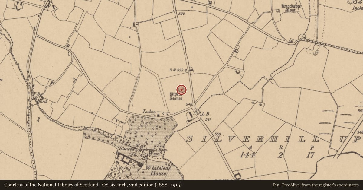
- Pipers Stones
- Latest-edition OS map
- Pipers Stones
- Coordinates
- 53.11094, -6.61205
- SMR number
- KD029-023----
Slide toward Today to fade the historical sheet and see the modern map underneath.
David Rumsey Map Collection, Stanford LibrariesDavid Rumsey Map Collection, Stanford LibrariesDavid Rumsey Map Collection, Stanford LibrariesDavid Rumsey Map Collection, Stanford Libraries
4 historical maps cover this location, the earliest the 1790 map "Composite: Ireland." (David Rumsey Map Collection, Stanford Libraries).
Historical maps covering this location
- 1790 · Composite: Ireland. (David Rumsey Map Collection, Stanford Libraries)
- 1799 · Ireland. (David Rumsey Map Collection, Stanford Libraries)
- 1830 · V.3:11-15:XV. Britisches Reich. C. Kon: Ireland. a. Prov: Leinster. Counties: 1-12 (David Rumsey Map Collection, Stanford Libraries)
- 1891 · Ireland 16 (David Rumsey Map Collection, Stanford Libraries)
This record in the National Monuments Service's Historic Environment Viewer ↗
The National Monuments Service's description
On a slightly raised (H 0.3m) platform-like area, on a low pasture rise. A circle (diams. 30m N-S; 31m E-W) of mostly granite boulders, now numbering 27, but originally probably 47/48 contiguous stones. The interior rises gently towards the W. (Fitzgerald 1899-1902, 353-4 – includes photograph; Walshe 1931, 130; Ó Nualláin 1975, 112). A second stone circle (KD029-032----), now destroyed, stood c. 830m to the SSW in Whiteleas townland.
Compiled by: Gearóid Conroy
Date of upload: 12 September 2013
This monument is subject to a preservation order made under the National Monuments Acts 1930 to 2014 (PO no. 92/1940).
References
Ó Nualláin, S. 1975 The stone circle complex of Cork and Kerry. Journal of the Royal Society of Antiquaries of Ireland 105, 83-131.
Walshe, P.T. 1931 The antiquities of the Dunlavin-Donard district. Journal of the Royal Society of Antiquaries of Ireland 61, 113-41.
FitzGerald, Lord W. 1899-1902(d) Ballymore Eustace and its neighbouring antiquities. Journal of the Kildare Archaeological Society 3, 357-9.
Nearby in the register
- Moundunder 1 mi
- Enclosureunder 1 mi
- Enclosureunder 1 mi
- Stone circleunder 1 mi
Other entries of the same register within about three miles of this one, by straight line.