Sites and Monuments Record · Ireland
Castle - tower house
Barretstown, County Kildare, Ireland
The record
- Townland
- Barretstown
- County
- Kildare
- Country
- Ireland
- First-edition OS map
- Indicated
- Latest-edition OS map
- Barretstown Castle
- Coordinates
- 53.15325, -6.59736
- SMR number
- KD024-029----
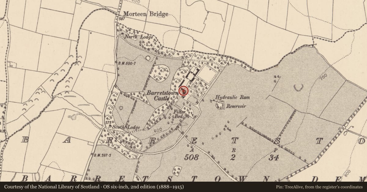
Slide toward Today to fade the historical sheet and see the modern map underneath.
David Rumsey Map Collection, Stanford LibrariesDavid Rumsey Map Collection, Stanford LibrariesDavid Rumsey Map Collection, Stanford LibrariesDavid Rumsey Map Collection, Stanford Libraries
4 historical maps cover this location, the earliest the 1790 map "Composite: Ireland." (David Rumsey Map Collection, Stanford Libraries).
Historical maps covering this location
- 1790 · Composite: Ireland. (David Rumsey Map Collection, Stanford Libraries)
- 1799 · Ireland. (David Rumsey Map Collection, Stanford Libraries)
- 1830 · V.3:11-15:XV. Britisches Reich. C. Kon: Ireland. a. Prov: Leinster. Counties: 1-12 (David Rumsey Map Collection, Stanford Libraries)
- 1891 · Ireland 16 (David Rumsey Map Collection, Stanford Libraries)
This record in the National Monuments Service's Historic Environment Viewer ↗
The National Monuments Service's description
In extensively landscaped grounds, attached to a two storied ‘slightly Ruskinian Gothic Victorian addition’ (Bence-Jones 1978, 33). The four storied tower house is rectangular in plan (int. 6.8m E-W; 4.5m N-S; wall T 1.3m) and has been completely modernised. Original floor levels have been altered, the crenelations, arrow loops (some false), and arched windows are all reconstructions, and the exterior is pebble-dashed. Its last private owner, Mr. W. G. Weston, presented it to the State which subsequently leased the castle and grounds to the Barretstown Gang Camp Fund, an organisation helping sick children. (Killanin and Duignan 1967, 102; CUCAP 1967 ATA 74)
Compiled by: Gearóid Conroy
Date of upload: 4 July 2012
References
Killanin, M.M. and Duignan, M.V. 1967 (2nd ed.) The Shell guide to Ireland. London. The Ebury Press.
Bence-Jones, M. 1978 Burke's Guide to Country Houses: Volume 1 Ireland. London. Burke's Peerage Ltd.
CUCAP - Cambridge University Collection of Aerial Photographs. Unit for Landscape Modelling, Department of Geography, University of Cambridge. See:https://www.cambridgeairphotos.com
Nearby in the register
- Habitation siteunder 1 mi
- Moundunder 1 mi
- Enclosureunder 1 mi
- Hilltop enclosure1 mi
Other entries of the same register within about three miles of this one, by straight line.