Sites and Monuments Record · Ireland
Barrow - ring-barrow
Silliothill (Carnalway ED), County Kildare, Ireland
The record
- Townland
- Silliothill (Carnalway ED)
- County
- Kildare
- Country
- Ireland
- First-edition OS map
- Hachured
- Latest-edition OS map
- Hachured
- Coordinates
- 53.15342, -6.71980
- SMR number
- KD024-027----
Slide toward Today to fade the historical sheet and see the modern map underneath.
David Rumsey Map Collection, Stanford LibrariesDavid Rumsey Map Collection, Stanford LibrariesDavid Rumsey Map Collection, Stanford LibrariesDavid Rumsey Map Collection, Stanford Libraries
4 historical maps cover this location, the earliest the 1790 map "Composite: Ireland." (David Rumsey Map Collection, Stanford Libraries).
Historical maps covering this location
- 1790 · Composite: Ireland. (David Rumsey Map Collection, Stanford Libraries)
- 1799 · Ireland. (David Rumsey Map Collection, Stanford Libraries)
- 1830 · V.3:11-15:XV. Britisches Reich. C. Kon: Ireland. a. Prov: Leinster. Counties: 1-12 (David Rumsey Map Collection, Stanford Libraries)
- 1891 · Ireland 16 (David Rumsey Map Collection, Stanford Libraries)
This record in the National Monuments Service's Historic Environment Viewer ↗
The National Monuments Service's description
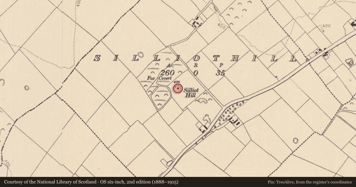
On Silliot Hill (OD 499 feet). A circular area (diam. 33m) is enclosed by a very regular earthen bank (H 1.4m; W 3.7m), with slight traces of an internal fosse. In 1955, it was noted that the bank looked ‘partially remodelled’, the fosse was some 12 feet (c. 3.65m) wide but was ‘effaced in parts’, and there was a ‘ruined summer house’ on the fosse and bank at NW (SMR file). Ó Murchadha (2002, 70) concludes that, ‘ … here, on or around Silliothill in the parish of Carnalway, Oenach Carmain was celebrated.’ Oenach/áenach generally denotes an assembly of people, and originally these celebrations were probably funeral rites, so that óenach became associated with such burial sites as Tailtiu, Brug na Bóinne and Emain Macha. Among the Laigin of south Leinster, the assembly known as Oenach Carmain was a highly esteemed one (ibid. 57).
Compiled by: Gearóid Conroy
Date of upload: 14 June 2012
References
Ó Murchadha, D. 2002 Carman, site of Óenach Carmain: a proposed location. Éigse 33, 57-70.
Nearby in the register
- Burialunder 1 mi
- House - Neolithicunder 1 mi
- House - Neolithicunder 1 mi
- House - Neolithicunder 1 mi
Other entries of the same register within about three miles of this one, by straight line.