Sites and Monuments Record · Ireland
Religious house - Carmelite friars
Kildare, County Kildare, Ireland
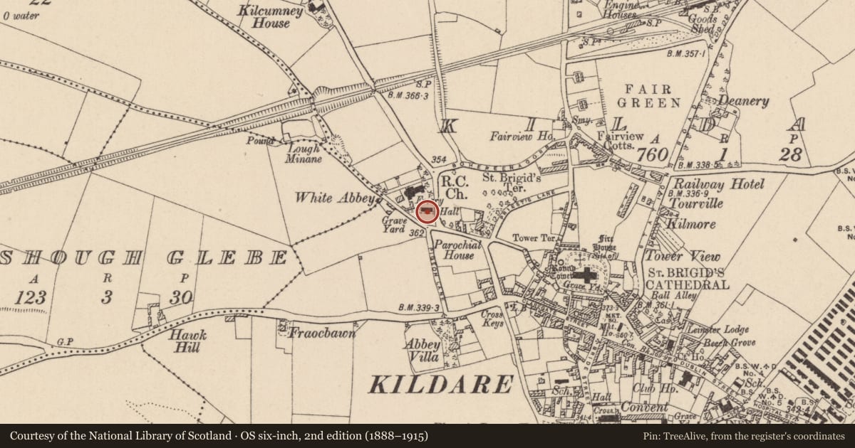
The record
- Townland
- Kildare
- County
- Kildare
- Country
- Ireland
- First-edition OS map
- Not indicated
- Latest-edition OS map
- Not indicated
- Coordinates
- 53.15903, -6.91627
- SMR number
- KD022-029007-
Slide toward Today to fade the historical sheet and see the modern map underneath.
David Rumsey Map Collection, Stanford LibrariesDavid Rumsey Map Collection, Stanford LibrariesDavid Rumsey Map Collection, Stanford LibrariesDavid Rumsey Map Collection, Stanford Libraries
4 historical maps cover this location, the earliest the 1790 map "Composite: Ireland." (David Rumsey Map Collection, Stanford Libraries).
Historical maps covering this location
- 1790 · Composite: Ireland. (David Rumsey Map Collection, Stanford Libraries)
- 1799 · Ireland. (David Rumsey Map Collection, Stanford Libraries)
- 1830 · V.3:11-15:XV. Britisches Reich. C. Kon: Ireland. a. Prov: Leinster. Counties: 1-12 (David Rumsey Map Collection, Stanford Libraries)
- 1891 · Ireland 16 (David Rumsey Map Collection, Stanford Libraries)
This record in the National Monuments Service's Historic Environment Viewer ↗
The National Monuments Service's description
Located to the WNW of St. Brigid’s Cathedral (KD022-029005-) in a graveyard (KD022-029061-). The Carmelite Priory of St Mary, founded by William de Vesci in 1290. In 1539 it consisted of a church, belfry, dormitory, hall, and two chambers. All the buildings except the church and messuage were burned in 1540 (Gwynn and Hadcock 1970, 290). According to Bradley et al. (1986 vol. 3, 243-6), a late-18th century drawing by Cooper shows a roofless, single-aisled church, with two small traceried roundels above in the E wall, six pointed lancets and a flat lintelled doorway towards the W in the S wall (JKAS 1971-6, 436, 490). There are no visible remains of the priory, but it is indicated on Rocque’s 1757 map immediately S of the modern Carmelite church. Late medieval limestone panels (KD022-029062-, KD022-029063-, KD022-029064-, KD022-029065- and KD022-029066-) set in the N transept wall of the modern church may have originated in the earlier church.
Compiled by: Gearóid Conroy
Date of upload: 23 January 2012
Nearby in the register
- Graveyardunder 1 mi
- Tomb - chest tombunder 1 mi
- Tomb - chest tombunder 1 mi
- Inscribed stoneunder 1 mi
Other entries of the same register within about three miles of this one, by straight line.