Sites and Monuments Record · Ireland
Barrow - ring-barrow
Kilteel Lower, County Kildare, Ireland
The record
- Townland
- Kilteel Lower
- County
- Kildare
- Country
- Ireland
- First-edition OS map
- Not indicated
- Latest-edition OS map
- Not indicated
- Coordinates
- 53.23597, -6.52876
- SMR number
- KD020-005----
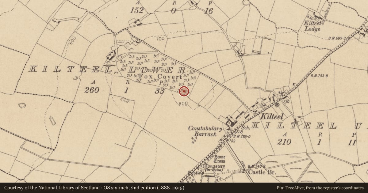
Slide toward Today to fade the historical sheet and see the modern map underneath.
David Rumsey Map Collection, Stanford LibrariesDavid Rumsey Map Collection, Stanford LibrariesDavid Rumsey Map Collection, Stanford LibrariesDavid Rumsey Map Collection, Stanford Libraries
4 historical maps cover this location, the earliest the 1799 map "Ireland." (David Rumsey Map Collection, Stanford Libraries).
Historical maps covering this location
- 1799 · Ireland. (David Rumsey Map Collection, Stanford Libraries)
- 1811 · Ireland. (David Rumsey Map Collection, Stanford Libraries)
- 1830 · V.3:11-15:XV. Britisches Reich. C. Kon: Ireland. a. Prov: Leinster. Counties: 1-12 (David Rumsey Map Collection, Stanford Libraries)
- 1891 · Ireland 16 (David Rumsey Map Collection, Stanford Libraries)
This record in the National Monuments Service's Historic Environment Viewer ↗
The National Monuments Service's description
A Registered Historic Monument. Shown as a circular feature in this general area on Taylor's Map of County Kildare (1783). Prominently sited on a wooded hilltop (OD 815 feet) with excellent views in all directions. A slightly raised, almost circular central area (diams. 25m E-W; 23m N-S; H 0.6-0.8m) has a small, low mound in its SW sector (diam 4.5m; H 0.6-0.7m), probably the remains of the Trigonometrical station shown on the OS 6-inch mapping, and is girdled by a broad, shallow fosse (Wth 6m), and a low outer bank (H 0.7m; Wth 2m). Intermittent traces of a possible second, narrow, shallow, outer fosse (Wth 1m; D 0.2m) may be a later feature. Some 4m to the SW, a large, roughly squared, stone block (dims. L 1.2m; Wth 1m; H 0.9m) appears to have been deliberately set in place, while two further, overgrown blocks to the SE are of uncertain significance. The monument may be a barrow which was subsequently modified for use as an inauguration site.
Compiled by: Gearóid Conroy
Date of upload: 10 June 2011
Nearby in the register
- Earthworkunder 1 mi
- Cross - High crossunder 1 mi
- Castle - tower houseunder 1 mi
- Gatehouseunder 1 mi
Other entries of the same register within about three miles of this one, by straight line.