Sites and Monuments Record · Ireland
Architectural fragment
Palmerstown Demesne, County Kildare, Ireland
The record
- Townland
- Palmerstown Demesne
- County
- Kildare
- Country
- Ireland
- First-edition OS map
- Not indicated
- Latest-edition OS map
- Not indicated
- Coordinates
- 53.24308, -6.62772
- SMR number
- KD019-067----
Slide toward Today to fade the historical sheet and see the modern map underneath.
David Rumsey Map Collection, Stanford LibrariesDavid Rumsey Map Collection, Stanford LibrariesDavid Rumsey Map Collection, Stanford LibrariesDavid Rumsey Map Collection, Stanford Libraries
4 historical maps cover this location, the earliest the 1790 map "Composite: Ireland." (David Rumsey Map Collection, Stanford Libraries).
Historical maps covering this location
- 1790 · Composite: Ireland. (David Rumsey Map Collection, Stanford Libraries)
- 1799 · Ireland. (David Rumsey Map Collection, Stanford Libraries)
- 1830 · V.3:11-15:XV. Britisches Reich. C. Kon: Ireland. a. Prov: Leinster. Counties: 1-12 (David Rumsey Map Collection, Stanford Libraries)
- 1891 · Ireland 16 (David Rumsey Map Collection, Stanford Libraries)
This record in the National Monuments Service's Historic Environment Viewer ↗
The National Monuments Service's description
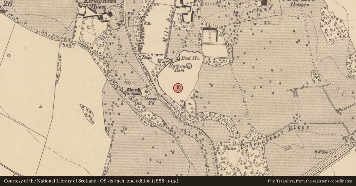
Discovered by Mr. Brian McCabe, a local historian. Located in a narrow strip of overgrown tree and scrub-covered ground along the W shore of a small lake in Palmerstown Demesne, which has been developed as a golf course. A well-dressed, chamfered limestone arch-stone (L 1.2m; Wth 0.25m; T 0.21m), with parallel tooling on the faces and punch-dressing on the soffit is reused to form the N side of a very low ope (H 1m) in the E gable wall of a small, poorly preserved, ivy clad structure, of which only portions of the N and E gable walls survive (L 7.2m E-W; Wth 4.4m N-S; H 3m), built of heavily mortared, mixed large and small roughly dressed stones. The walls (T 0.46m) are each pierced by a tall ope in pointed, Gothic-arch style with rough, undressed voussoirs, and some tufa is used in the jambs (N wall ope H 2.4m; Wth 0.87m: S wall ope (to the N of the arch stone) H 2.5m; Wth 1.48m). This structure appears to be landscape demesne feature, while the reused arch-stone may have come from Kerdiffstown Church (KD019-006001-) c. 150m to the W.
Compiled by: Gearóid Conroy
Date of upload: 10 June 2011
Nearby in the register
Other entries of the same register within about three miles of this one, by straight line.