Sites and Monuments Record · Ireland
Excavation - miscellaneous
Naas West, County Kildare, Ireland
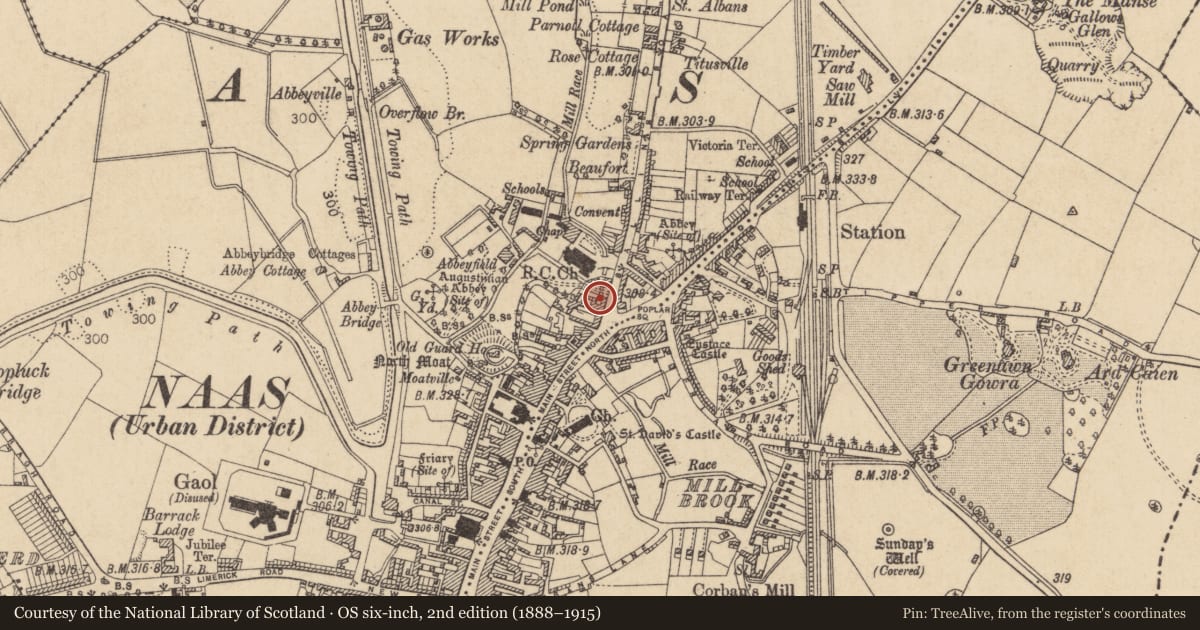
The record
- Townland
- Naas West
- County
- Kildare
- Country
- Ireland
- First-edition OS map
- Not indicated
- Latest-edition OS map
- Not indicated
- Coordinates
- 53.21967, -6.66232
- SMR number
- KD019-030041-
Slide toward Today to fade the historical sheet and see the modern map underneath.
David Rumsey Map Collection, Stanford LibrariesDavid Rumsey Map Collection, Stanford LibrariesDavid Rumsey Map Collection, Stanford LibrariesDavid Rumsey Map Collection, Stanford Libraries
4 historical maps cover this location, the earliest the 1790 map "Composite: Ireland." (David Rumsey Map Collection, Stanford Libraries).
Historical maps covering this location
- 1790 · Composite: Ireland. (David Rumsey Map Collection, Stanford Libraries)
- 1799 · Ireland. (David Rumsey Map Collection, Stanford Libraries)
- 1830 · V.3:11-15:XV. Britisches Reich. C. Kon: Ireland. a. Prov: Leinster. Counties: 1-12 (David Rumsey Map Collection, Stanford Libraries)
- 1891 · Ireland 16 (David Rumsey Map Collection, Stanford Libraries)
This record in the National Monuments Service's Historic Environment Viewer ↗
The National Monuments Service's description
Archaeological trial-trenching (Licence no. 97E0299: www.excavations.ie) undertaken at No. 1A North Main St. revealed five layers of which one, the basal layer, was of archaeological interest. It consisted of a dark brown/black soft clayey silt which was organic in nature. This material generally existed in pockets/depressions in the underlying subsoil, but a continuous layer was also uncovered. The material had an average thickness of 0.1m and produced a number of leather scraps and cattle horn-core fragments. However, no features or structures were encountered, although a number of sherds of medieval and post-medieval pottery were recovered from the upper non-archaeological layers. The lowering of ground level by up to 0.3m across the entire rear area of the site and the excavation of building foundations were also monitored (Licence no. 97E0299 ext.). A number of sherds of post-medieval pottery were recovered from the upper layers and one sherd of medieval pottery was recovered from the silty basal layer.
Compiled by: Gearóid Conroy
Date of upload: 10 June 2011
Nearby in the register
- Excavation - miscellaneousunder 1 mi
- House - medievalunder 1 mi
- Castle - unclassifiedunder 1 mi
- Excavation - miscellaneousunder 1 mi
Other entries of the same register within about three miles of this one, by straight line.