Sites and Monuments Record · Ireland
Church
Jigginstown, County Kildare, Ireland
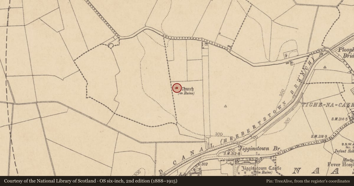
The record
- Townland
- Jigginstown
- County
- Kildare
- Country
- Ireland
- First-edition OS map
- Church
- Latest-edition OS map
- Church (in Ruins)
- Coordinates
- 53.21706, -6.68762
- SMR number
- KD019-029----
Slide toward Today to fade the historical sheet and see the modern map underneath.
David Rumsey Map Collection, Stanford LibrariesDavid Rumsey Map Collection, Stanford LibrariesDavid Rumsey Map Collection, Stanford LibrariesDavid Rumsey Map Collection, Stanford Libraries
4 historical maps cover this location, the earliest the 1790 map "Composite: Ireland." (David Rumsey Map Collection, Stanford Libraries).
Historical maps covering this location
- 1790 · Composite: Ireland. (David Rumsey Map Collection, Stanford Libraries)
- 1799 · Ireland. (David Rumsey Map Collection, Stanford Libraries)
- 1830 · V.3:11-15:XV. Britisches Reich. C. Kon: Ireland. a. Prov: Leinster. Counties: 1-12 (David Rumsey Map Collection, Stanford Libraries)
- 1891 · Ireland 16 (David Rumsey Map Collection, Stanford Libraries)
This record in the National Monuments Service's Historic Environment Viewer ↗
The National Monuments Service's description
Named 'Templecarragh' on Noble and Keenan's 1752 Map of County Kildare, and 'Temple Carragh' (in ruins) on Taylor's 1782 map of the county. At the N end of a short, low, N-S pasture ridge. A very poorly preserved, rectangular structure (int. dims. L 8.3m E-W; Wth 4.1m) is built of randomly coursed limestone blocks and flags. The thick walls (av. T 1m) are almost levelled (max. H 1.6m) and a rubble-filled gap (Wth 1.4m) to W of centre in the N wall may be the site of the original doorway. Windows do not survive, but gaps in the E gable wall (Wth 1.5m) and near the W end of the S wall (Wth 1.6m) mark their locations. A single, chamfered quoin is visible on the external SE angle. A grass covered, raised, rectangular area, running E from the E gable (L 7.4m E-W), defined by a scarp (H 0.8m) may be the remains of an associated structure, although it appears unlikely to have been a chancel. Fitzgerald (1905, 355) noted the occurrence of human bones at the site, suggesting a possible graveyard (KD019-029001-).
Compiled by: Gearóid Conroy
Date of upload: 10 June 2011
Nearby in the register
- Graveyardunder 1 mi
- Gatehouseunder 1 mi
- Castle - tower houseunder 1 mi
- House - 17th centuryunder 1 mi
Other entries of the same register within about three miles of this one, by straight line.