Sites and Monuments Record · Ireland
Enclosure
Forenaghts Great, County Kildare, Ireland
The record
- Townland
- Forenaghts Great
- County
- Kildare
- Country
- Ireland
- First-edition OS map
- Hachured
- Latest-edition OS map
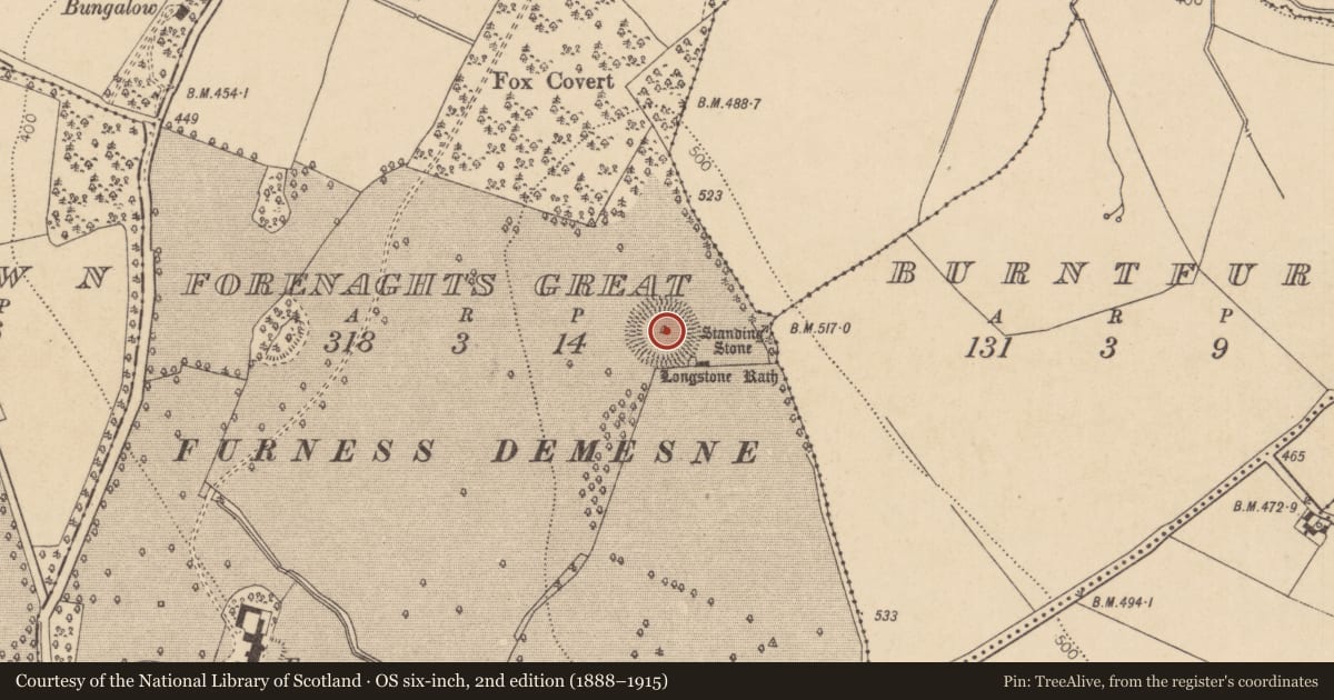
- Longstone Rath
- Coordinates
- 53.22778, -6.59728
- SMR number
- KD019-022001-
Slide toward Today to fade the historical sheet and see the modern map underneath.
David Rumsey Map Collection, Stanford LibrariesDavid Rumsey Map Collection, Stanford LibrariesDavid Rumsey Map Collection, Stanford LibrariesDavid Rumsey Map Collection, Stanford Libraries
4 historical maps cover this location, the earliest the 1790 map "Composite: Ireland." (David Rumsey Map Collection, Stanford Libraries).
Historical maps covering this location
- 1790 · Composite: Ireland. (David Rumsey Map Collection, Stanford Libraries)
- 1799 · Ireland. (David Rumsey Map Collection, Stanford Libraries)
- 1830 · V.3:11-15:XV. Britisches Reich. C. Kon: Ireland. a. Prov: Leinster. Counties: 1-12 (David Rumsey Map Collection, Stanford Libraries)
- 1891 · Ireland 16 (David Rumsey Map Collection, Stanford Libraries)
This record in the National Monuments Service's Historic Environment Viewer ↗
The National Monuments Service's description
At the N end of a narrow, moderately steep-sided, N-S pasture ridge on the landscaped grounds of Furness House. A small burial cairn (KD019-23----) lies c. 65m to the SE. A large circular area (diam. 63m) is defined by an inner earthen bank (Wth 6-8m; av. H 2m) with almost opposing entrance gaps at ENE and W, and by an outer fosse. Slight traces of a second, outer bank were noted in 1972 (SMR file). The interior rises gently towards the centre where there is a very fine standing stone (KD019-022002-), beside which and a cist (KD019-022003-) was discovered. Visible on a 2006 aerial photograph (SMR file) with the enclosing bank partially denuded of sod cover, apparently by livestock. The monument is the subject of a Preservation Order (No.95). The occurrence of standing stones associated with enclosures is known elsewhere in County Kildare, including Punchestown (KD024-0099001- and KD024-0099002-) and Mullaghmast (KD036-010---- and KD036-017----).
(Herity 2002, 23 (66); De Burg 1896, 315, 317, 324; Mayo, Earl of, 1899-1902, 57, 59; Synnott 1899-1902, 454, 466-8; Macalister/Praeger/Armstrong 1912-14, 288-295; Killanin and Duignan 1967, 384; Waddell 1970, 119; Weir 1980, 167)
Compiled by: Gearóid Conroy
Date of upload: 10 June 2011
This monument is subject to a preservation order made under the National Monuments Acts 1930 to 2014 (PO no. 95/1940).
Nearby in the register
- Cistunder 1 mi
- Standing stoneunder 1 mi
- Cairn - burial cairnunder 1 mi
- Enclosureunder 1 mi
Other entries of the same register within about three miles of this one, by straight line.