Sites and Monuments Record · Ireland
Mound
Carrickanearla,Kilmoney South, County Kildare, Ireland
The record
- Townland
- Carrickanearla,Kilmoney South
- County
- Kildare
- Country
- Ireland
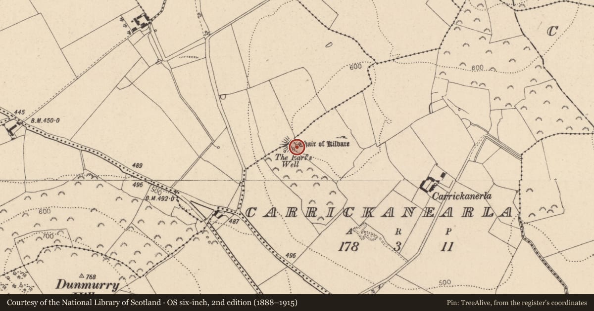
- First-edition OS map
- Chair of Kildare
- Latest-edition OS map
- Chair of Kildare
- Coordinates
- 53.20173, -6.92332
- SMR number
- KD017-028001-
Slide toward Today to fade the historical sheet and see the modern map underneath.
David Rumsey Map Collection, Stanford LibrariesDavid Rumsey Map Collection, Stanford LibrariesDavid Rumsey Map Collection, Stanford LibrariesDavid Rumsey Map Collection, Stanford Libraries
4 historical maps cover this location, the earliest the 1790 map "Composite: Ireland." (David Rumsey Map Collection, Stanford Libraries).
Historical maps covering this location
- 1790 · Composite: Ireland. (David Rumsey Map Collection, Stanford Libraries)
- 1799 · Ireland. (David Rumsey Map Collection, Stanford Libraries)
- 1830 · V.3:11-15:XV. Britisches Reich. C. Kon: Ireland. a. Prov: Leinster. Counties: 1-12 (David Rumsey Map Collection, Stanford Libraries)
- 1891 · Ireland 16 (David Rumsey Map Collection, Stanford Libraries)
This record in the National Monuments Service's Historic Environment Viewer ↗
The National Monuments Service's description
Prominently sited on a narrow cliff-edged terrace on the SW slope of Grange Hill (OD 743 feet) and commanding a narrow pass between Grange Hill and Dunmurry Hill (OD 769 feet) to the SW. The monument is named for and associated in local tradition with the Earls of Kildare. A fairly well-preserved, though partly overgrown, high, steep-sided, flat-topped, circular, earthen mound (diam. at base 21m; diam at top 9m; H 2m at NE-5.5m at SE) carries a shallow, square depression (dims. L 4m; Wth 4m; D 0.6m) on the SW surface which may be the remains of a castle (KD017-028002-). A lower, sub-rectangular area (dims. L c. 28m NW-SE; Wth c. 26m) abuts the mound at SW and is defined by a low scarp (H 0.4-1m). It is terraced, with the slightly higher NE quarter, abutting the mound, retained by a low grassed-over stone wall (Wth 3.7m; H0.2-0.7m). A townland boundary wall runs NE-SW over the NW of the monument.
Compiled by: Gearóid Conroy
Date of upload: 10 June 2011
Nearby in the register
- Inauguration siteunder 1 mi
- Castle - unclassifiedunder 1 mi
- Architectural fragmentunder 1 mi
- Wellunder 1 mi
Other entries of the same register within about three miles of this one, by straight line.