Sites and Monuments Record · Ireland
Moated site
Drumsru (Kilmeage North ED), County Kildare, Ireland
The record
- Townland
- Drumsru (Kilmeage North ED)
- County
- Kildare
- Country
- Ireland
- First-edition OS map
- Hachured
- Latest-edition OS map
- Hachured
- Coordinates
- 53.25584, -6.91860
- SMR number
- KD017-003----
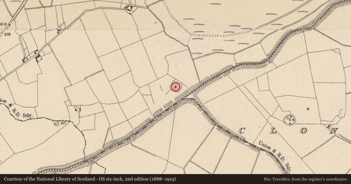
Slide toward Today to fade the historical sheet and see the modern map underneath.
David Rumsey Map Collection, Stanford LibrariesDavid Rumsey Map Collection, Stanford LibrariesDavid Rumsey Map Collection, Stanford LibrariesDavid Rumsey Map Collection, Stanford Libraries
4 historical maps cover this location, the earliest the 1790 map "Composite: Ireland." (David Rumsey Map Collection, Stanford Libraries).
Historical maps covering this location
- 1790 · Composite: Ireland. (David Rumsey Map Collection, Stanford Libraries)
- 1799 · Ireland. (David Rumsey Map Collection, Stanford Libraries)
- 1830 · V.3:11-15:XV. Britisches Reich. C. Kon: Ireland. a. Prov: Leinster. Counties: 1-12 (David Rumsey Map Collection, Stanford Libraries)
- 1891 · Ireland 16 (David Rumsey Map Collection, Stanford Libraries)
This record in the National Monuments Service's Historic Environment Viewer ↗
The National Monuments Service's description
On level pasture c. 50m N of the SW-flowing Slate River and located almost equidistantly between two raths; KD017-002---- c. 700m to the WSW and KD017-004---- c. 800m to the ESE. A large square area (int. dims. L c. 40m; Wth c. 40m) is defined by a very poorly preserved inner earthen bank (Wth 2.6m; int H 0.2m; ext. H 1.7m) along the E side, and by a broad, steep-sided outer fosse (Wth. 4.9-5.6m; D 1-1.3m). A large limestone block (L 0.8m; H 0.15m) retains the outer face of the fosse mid-way along the N side and to its E several even larger blocks (L 1.1m; Wth 0.8m; H 0.9m) have slipped to the bottom of the fosse but may originally have been part of an entrance to the site. The fosse is heavily poached by livestock along the S side and a later field bank runs on its outer edge along the W. The interior is almost completely overgrown with blackthorn, briar, holly and hazel, some of which is coppiced.
Compiled by: Gearóid Conroy
Date of upload: 10 June 2011
Nearby in the register
- Ringfort - rathunder 1 mi
- Ringfort - rathunder 1 mi
- Structure - peatlandunder 1 mi
- Platform - peatlandunder 1 mi
Other entries of the same register within about three miles of this one, by straight line.