Sites and Monuments Record · Ireland
Wall monument
Lyons, County Kildare, Ireland
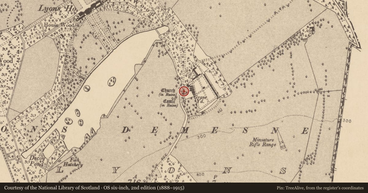
The record
- Townland
- Lyons
- County
- Kildare
- Country
- Ireland
- First-edition OS map
- Not indicated
- Latest-edition OS map
- Not indicated
- Coordinates
- 53.29787, -6.53847
- SMR number
- KD015-004003-
Slide toward Today to fade the historical sheet and see the modern map underneath.
David Rumsey Map Collection, Stanford LibrariesDavid Rumsey Map Collection, Stanford LibrariesDavid Rumsey Map Collection, Stanford LibrariesDavid Rumsey Map Collection, Stanford Libraries
4 historical maps cover this location, the earliest the 1799 map "Ireland." (David Rumsey Map Collection, Stanford Libraries).
Historical maps covering this location
- 1799 · Ireland. (David Rumsey Map Collection, Stanford Libraries)
- 1811 · Ireland. (David Rumsey Map Collection, Stanford Libraries)
- 1830 · V.3:11-15:XV. Britisches Reich. C. Kon: Ireland. a. Prov: Leinster. Counties: 1-12 (David Rumsey Map Collection, Stanford Libraries)
- 1891 · Ireland 16 (David Rumsey Map Collection, Stanford Libraries)
This record in the National Monuments Service's Historic Environment Viewer ↗
The National Monuments Service's description
According to Killanin and Duignan (1967, 160), 'The 1548 memorial to Richard Aylmer bears the arms of the Flemmings of Slane and the Tyrells. The Tyrells got possession of Lyons in the Middle Ages. From them it passed, seemingly by marriage, to the Aylmer family. The Aylmers sold it to the first Lord Cloncurry.' Built into the N wall of a church (KD015-004001-). A small rectangular plaque (dims. Wth 0.8m; H 0.66m) bears two decorated shields bordered by faded text. (Aylmer 1891-95, 299, 304-5)
Compiled by: Gearóid Conroy
Date of upload: 10 June 2011
Nearby in the register
- Fontunder 1 mi
- Wall monumentunder 1 mi
- Churchunder 1 mi
- Graveyardunder 1 mi
Other entries of the same register within about three miles of this one, by straight line.