Sites and Monuments Record · Ireland
Font
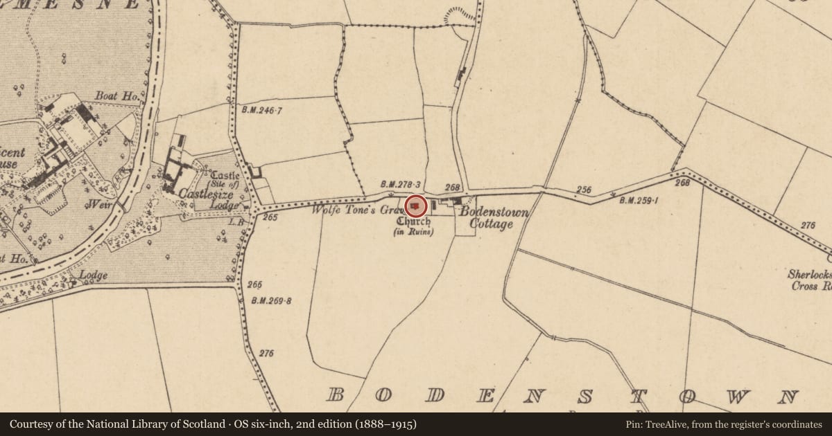
Bodenstown, County Kildare, Ireland
The record
- Townland
- Bodenstown
- County
- Kildare
- Country
- Ireland
- First-edition OS map
- Not indicated
- Latest-edition OS map
- Not indicated
- Coordinates
- 53.26615, -6.66521
- SMR number
- KD014-041003-
Slide toward Today to fade the historical sheet and see the modern map underneath.
David Rumsey Map Collection, Stanford LibrariesDavid Rumsey Map Collection, Stanford LibrariesDavid Rumsey Map Collection, Stanford LibrariesDavid Rumsey Map Collection, Stanford Libraries
4 historical maps cover this location, the earliest the 1790 map "Composite: Ireland." (David Rumsey Map Collection, Stanford Libraries).
Historical maps covering this location
- 1790 · Composite: Ireland. (David Rumsey Map Collection, Stanford Libraries)
- 1799 · Ireland. (David Rumsey Map Collection, Stanford Libraries)
- 1830 · V.3:11-15:XV. Britisches Reich. C. Kon: Ireland. a. Prov: Leinster. Counties: 1-12 (David Rumsey Map Collection, Stanford Libraries)
- 1891 · Ireland 16 (David Rumsey Map Collection, Stanford Libraries)
This record in the National Monuments Service's Historic Environment Viewer ↗
The National Monuments Service's description
In Bodenstown church (KD014-041001-). Two granite pieces appear to be part of the same, possibly 13th century baptismal font. One piece is square (dims. L 0.67m; Wth 0.67m) with a central, circular perforation (upper diam. 0.23m; base diam. 0.009m) and forms part of the base. The second, slightly larger piece (dims. L 0.8m; Wth 0.8m) contains a shallow basin which has small, opposing mortices. Sherlock (1899-1902, 298-9) explains that the opposing mortices on a very similar font (KD014-042002-) from Sherlockstown, c. 1 mile to the ESE, would have contained 'iron rivets leaded into the stone for the cover and lock required by the Constitution of Edward, Archbishop of Canterbury, in 1236' .
Compiled by: Gearóid Conroy
Date of upload: 10 June 2011
Nearby in the register
- Churchunder 1 mi
- Graveyardunder 1 mi
- Ring-ditchunder 1 mi
- Ring-ditchunder 1 mi
Other entries of the same register within about three miles of this one, by straight line.