Sites and Monuments Record · Ireland
Castle - tower house
Sherlockstown, County Kildare, Ireland
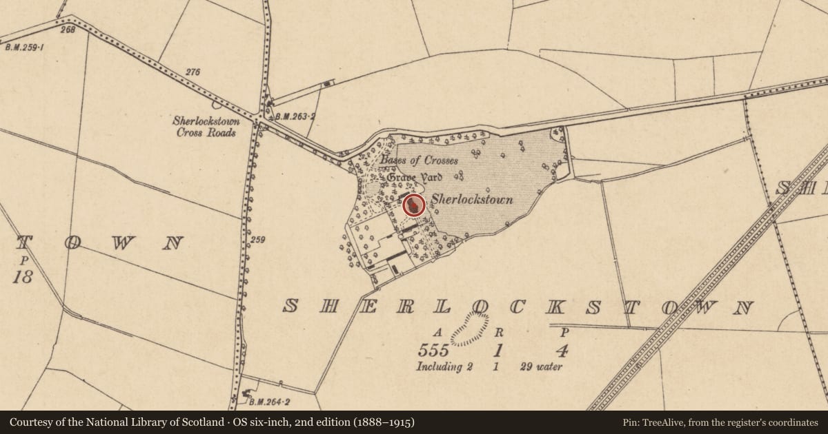
The record
- Townland
- Sherlockstown
- County
- Kildare
- Country
- Ireland
- First-edition OS map
- Not indicated
- Latest-edition OS map
- Not indicated
- Coordinates
- 53.26331, -6.64620
- SMR number
- KD014-027----
Slide toward Today to fade the historical sheet and see the modern map underneath.
David Rumsey Map Collection, Stanford LibrariesDavid Rumsey Map Collection, Stanford LibrariesDavid Rumsey Map Collection, Stanford LibrariesDavid Rumsey Map Collection, Stanford Libraries
4 historical maps cover this location, the earliest the 1790 map "Composite: Ireland." (David Rumsey Map Collection, Stanford Libraries).
Historical maps covering this location
- 1790 · Composite: Ireland. (David Rumsey Map Collection, Stanford Libraries)
- 1799 · Ireland. (David Rumsey Map Collection, Stanford Libraries)
- 1830 · V.3:11-15:XV. Britisches Reich. C. Kon: Ireland. a. Prov: Leinster. Counties: 1-12 (David Rumsey Map Collection, Stanford Libraries)
- 1891 · Ireland 16 (David Rumsey Map Collection, Stanford Libraries)
This record in the National Monuments Service's Historic Environment Viewer ↗
The National Monuments Service's description
According Tickell (1960, 379) Hugh de Lacy and his son had a castle at Sherlockstown, while Fitzgerald (1903, 68) records, 'Sir Walter Dongan (inherited) in 1592 (and) was … created a Baronet … in 1623. His Kildare possessions consisted of the Manor of Sherlockstown, containing one castle … .' This castle was probably a tower house which may subsequently have been incorporated into Sherlockstown House, described by Bence-Jones (1978, 259) as, 'a long, irregular, slightly castellated house (with a) tower-like centre.' On landscaped grounds c. 100m S of a medieval church and graveyard (KD014-042----).
Compiled by: Gearóid Conroy
Date of upload: 10 June 2011
References
Tickell, E. F. 1960 The Eustace Family and their lands in County Kildare, Part 3. Journal of the Kildare Archaeological Society 13, 364-413.
Bence-Jones, M. 1978 Burke's Guide to Country Houses: Volume 1 Ireland. London. Burke's Peerage Ltd.
Nearby in the register
- Churchunder 1 mi
- Cross - Wayside cross (present location)under 1 mi
- Fontunder 1 mi
- Graveyardunder 1 mi
Other entries of the same register within about three miles of this one, by straight line.