Sites and Monuments Record · Ireland
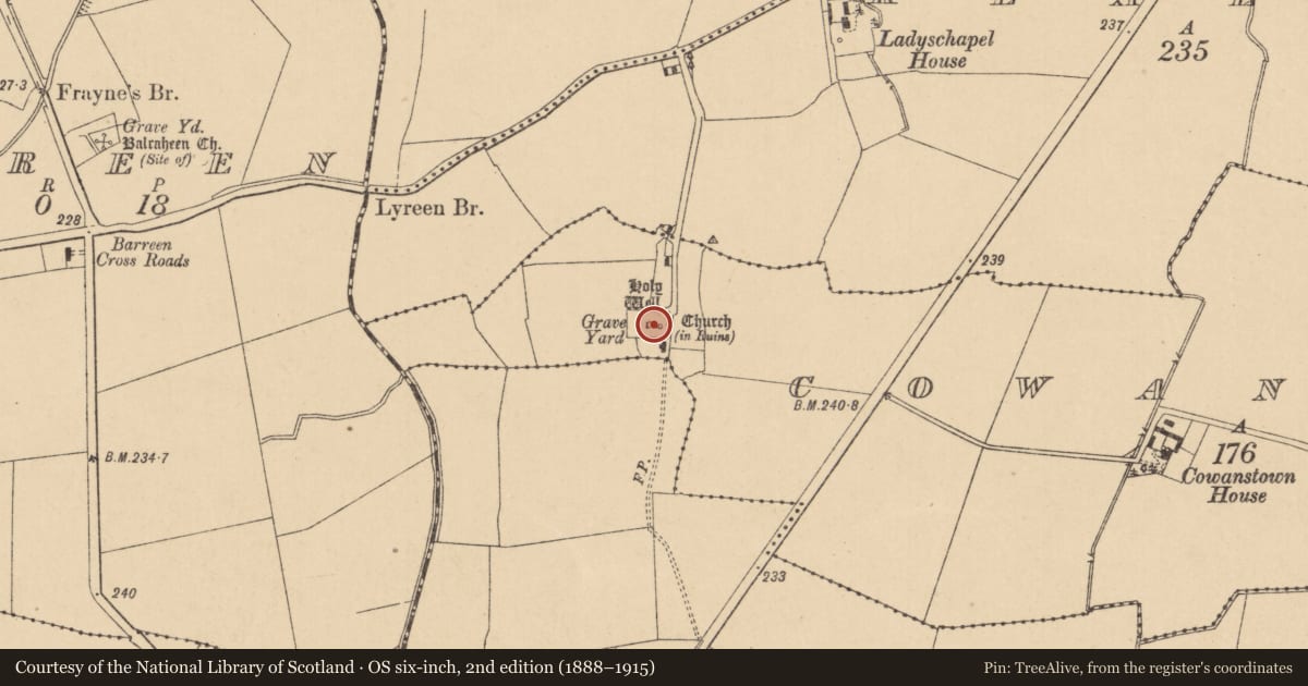
Church
Cowanstown, County Kildare, Ireland
The record
- Townland
- Cowanstown
- County
- Kildare
- Country
- Ireland
- First-edition OS map
- Church Ladys Chapel
- Latest-edition OS map
- Church (in Ruins)
- Coordinates
- 53.34889, -6.65277
- SMR number
- KD010-013----
Slide toward Today to fade the historical sheet and see the modern map underneath.
David Rumsey Map Collection, Stanford LibrariesDavid Rumsey Map Collection, Stanford LibrariesDavid Rumsey Map Collection, Stanford LibrariesDavid Rumsey Map Collection, Stanford Libraries
4 historical maps cover this location, the earliest the 1790 map "Composite: Ireland." (David Rumsey Map Collection, Stanford Libraries).
Historical maps covering this location
- 1790 · Composite: Ireland. (David Rumsey Map Collection, Stanford Libraries)
- 1799 · Ireland. (David Rumsey Map Collection, Stanford Libraries)
- 1830 · V.3:11-15:XV. Britisches Reich. C. Kon: Ireland. a. Prov: Leinster. Counties: 1-12 (David Rumsey Map Collection, Stanford Libraries)
- 1891 · Ireland 16 (David Rumsey Map Collection, Stanford Libraries)
This record in the National Monuments Service's Historic Environment Viewer ↗
The National Monuments Service's description
According to the OSL (Herity 2002, 11), 'This ruin is called by the people "Lady's Chapel" within two perches of which is a well called "Lady's Well" (KD010-013001-). Lady's Day, 15nth (sic) of August was formerly celebrated at this Chapel; but the frequency of the people to it on this occasion, has ceased now some years back. This Chapel is in connection with Taghtoo (Taghadoe (KD010-014001-)), taken notice of in the Inquisitions of the time of James the 1st. (1603-25) viz. " … 1 other free chapel (chapel of ease) near Taghtoo, called our Lady's Chapele"'. Near the centre of a graveyard (designated KD010-013002-). A very poorly preserved rectangular structure (int. dims. L 15.35m E-W; Wth 6.05m N-S), only the E and W gable walls of which survive, built of roughly coursed mortared stones. The E wall (T 0.85m) contains an apparently rebuilt round-arched window and the W wall (T 1.27m) contains an altered square-headed window and the gable carries a fine double bellcote. Numerous headstones and table tombs occupy the interior. A holy well (KD010-013001-) lies 2m E of the E gable.
Compiled by: Gearóid Conroy
Date of upload: 10 June 2011
Nearby in the register
- Ritual site - holy wellunder 1 mi
- Graveyardunder 1 mi
- Churchunder 1 mi
- Graveyardunder 1 mi
Other entries of the same register within about three miles of this one, by straight line.