Sites and Monuments Record · Ireland
Church
Carrick (Carrick ED), County Kildare, Ireland
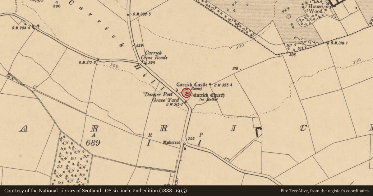
The record
- Townland
- Carrick (Carrick ED)
- County
- Kildare
- Country
- Ireland
- First-edition OS map
- Carrick Church
- Latest-edition OS map
- Carrick Church (in Ruins)
- Coordinates
- 53.37788, -7.03757
- SMR number
- KD002-010002-
Slide toward Today to fade the historical sheet and see the modern map underneath.
David Rumsey Map Collection, Stanford LibrariesDavid Rumsey Map Collection, Stanford LibrariesDavid Rumsey Map Collection, Stanford LibrariesDavid Rumsey Map Collection, Stanford Libraries
4 historical maps cover this location, the earliest the 1790 map "Composite: Ireland." (David Rumsey Map Collection, Stanford Libraries).
Historical maps covering this location
- 1790 · Composite: Ireland. (David Rumsey Map Collection, Stanford Libraries)
- 1799 · Ireland. (David Rumsey Map Collection, Stanford Libraries)
- 1869 · Ireland. (David Rumsey Map Collection, Stanford Libraries)
- 1891 · Ireland 16 (David Rumsey Map Collection, Stanford Libraries)
This record in the National Monuments Service's Historic Environment Viewer ↗
The National Monuments Service's description
In the E sector of an older, possibly early ecclesiastical enclosure (KD002-010001-) contained in a later graveyard (KD002-010003-). A completely rebuilt rectangular structure (int. dims. L 25m E-W; Wth 6.9m N-S; Wall T 0.55m at N-1.06m at S) of small, coursed, mortared limestone blocks with a short length of older, foundation walling (L 1.6m) visible near the E end of the N wall. The W gable is squared-off but an older gable's A-line is visible on the inner wall face. A rebuilt doorway (Wth 1.1m) at W end of the N wall gives access and two ogee-headed windows, one with hood-moulding, towards the E end of the S wall may be later insertions. The E-most window may have been taken from Carrick castle (KD002-009----) c. 40 m to the NW (A. Brindley, pers. comm. SMR file). The interior is filled with burials and the E end is walled-off to form a private, 19th c. burial plot with box-tombs which is accessed through iron gates in the N wall.
Compiled by: Gearóid Conroy
Date of upload: 10 June 2011
Nearby in the register
- Graveyardunder 1 mi
- Ecclesiastical enclosureunder 1 mi
- Sheela-na-gigunder 1 mi
- Castle - hall-houseunder 1 mi
Other entries of the same register within about three miles of this one, by straight line.