Sites and Monuments Record · Ireland
Ecclesiastical enclosure
Newtown (Glynn), County Galway, Ireland
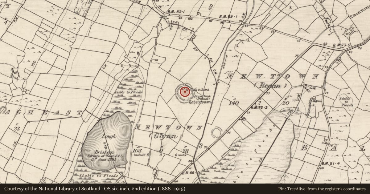
The record
- Townland
- Newtown (Glynn)
- County
- Galway
- Country
- Ireland
- First-edition OS map
- Hachured
- Latest-edition OS map
- Hachured
- Coordinates
- 53.05670, -8.86833
- SMR number
- GA122-120001-
Slide toward Today to fade the historical sheet and see the modern map underneath.
David Rumsey Map Collection, Stanford LibrariesDavid Rumsey Map Collection, Stanford LibrariesDavid Rumsey Map Collection, Stanford LibrariesDavid Rumsey Map Collection, Stanford Libraries
4 historical maps cover this location, the earliest the 1753 map "Mappa geographica Regni Hiberniae" (David Rumsey Map Collection, Stanford Libraries).
Historical maps covering this location
- 1753 · Mappa geographica Regni Hiberniae (David Rumsey Map Collection, Stanford Libraries)
- 1790 · Composite: Ireland. (David Rumsey Map Collection, Stanford Libraries)
- 1869 · Ireland. (David Rumsey Map Collection, Stanford Libraries)
- 1891 · Ireland 16 (David Rumsey Map Collection, Stanford Libraries)
This record in the National Monuments Service's Historic Environment Viewer ↗
The National Monuments Service's description
On a gentle SE-facing slope overlooking lower marshy land and a small stream to the E. This fairly well-preserved subcircular enclosure (68m N-S; 62m E-W) is defined by a substantial grassed-over stony bank and a wide deep external fosse. The bank is visible all round but is denuded at NE and overgrown with thorn trees and briars at E; it is best preserved at NW (Wth 2m; int. H 1.9m; ext. H 3m). The fosse (Wth 4m; D 1.8m) is also best preserved at NW, elsewhere field-clearance rubble and felled trees have been dumped in it and it is almost totally infilled in the S sector as a result. A trackway cuts across both enclosing elements at NNE. The interior is divided along a natural scarp line by a stony bank (Wth 1.2m; H 0.75m) running from NW to SE. There is a church (GA122-120002-) in the NNW sector and a small burial ground (GA122-120003-) in the SE sector. A holy well (GA122-121----) lies c. 90m to the ESE.
Compiled by: Olive Alcock
Date of upload: 30 March 2020
Nearby in the register
- Churchunder 1 mi
- Burial groundunder 1 mi
- Ritual site - holy wellunder 1 mi
- Ringfort - rathunder 1 mi
Other entries of the same register within about three miles of this one, by straight line.